Hazard Mitigation in a Historic Context – Wrapping up the Disaster Planning for Historic Properties Initiative
Three years ago, the Pennsylvania Historic Preservation Office (PA SHPO) announced that we were embarking on a new initiative to, for the first time in this office’s history, address the risks posed to historic properties by natural hazards, storms, and disasters.
We called this project the Disaster Planning for Historic Properties Initiative (DPHPI), and, following an extensive collaborative process with two consultants, three counties, one city, and the Pennsylvania Emergency Management Agency (PEMA), as well as too many other local stakeholders to mention individually, we are in the home stretch and ready to present our results.
This post and a second in a few weeks talks about the conclusion of this statewide project. If you’d like to know more, plan on attending a presentation on Phase 2 of this initiative, join the PA SHPO and project representatives in Philadelphia on May 31st.
Phase 2
For the past twelve months, PA SHPO, in collaboration with Vision Planning and Consulting (VPC), of Columbia, Maryland, has been working on Phase 2 of the DPHPI, which builds on our Phase 1 survey efforts by incorporating historic preservation considerations into the Pennsylvania State Hazard Mitigation Plan as well as four individual County Hazard Mitigation Plans. This project began with enhanced surveys in four pilot counties: Bedford, Cameron, Monroe, and the city of Philadelphia.
Because we couldn’t address every one of Pennsylvania’s 67 counties, one of our priorities in selecting pilot counties was that they be as representative of the diversity of places in the Commonwealth as possible. For each pilot county, a final report will be produced, and the goal is for each report to serve as a prototype that other counties can reference. County Hazard Mitigation Plans must be updated once every five years, so even counties with brand new Plans will need to start working on their next update soon.
County Contexts
The project team started by taking a detailed look at the history of early settlements in each county to understand how they came to be located in areas with heightened flood risk. While new communities today are often associated with highways, and communities in previous generations were located along important rail lines, the earliest settlement of communities in these counties was dependent on water bodies.
As an urban center of commerce, Philadelphia relied on the Schuylkill and Delaware Rivers to move goods and materials to other port communities up and down the Atlantic coast.
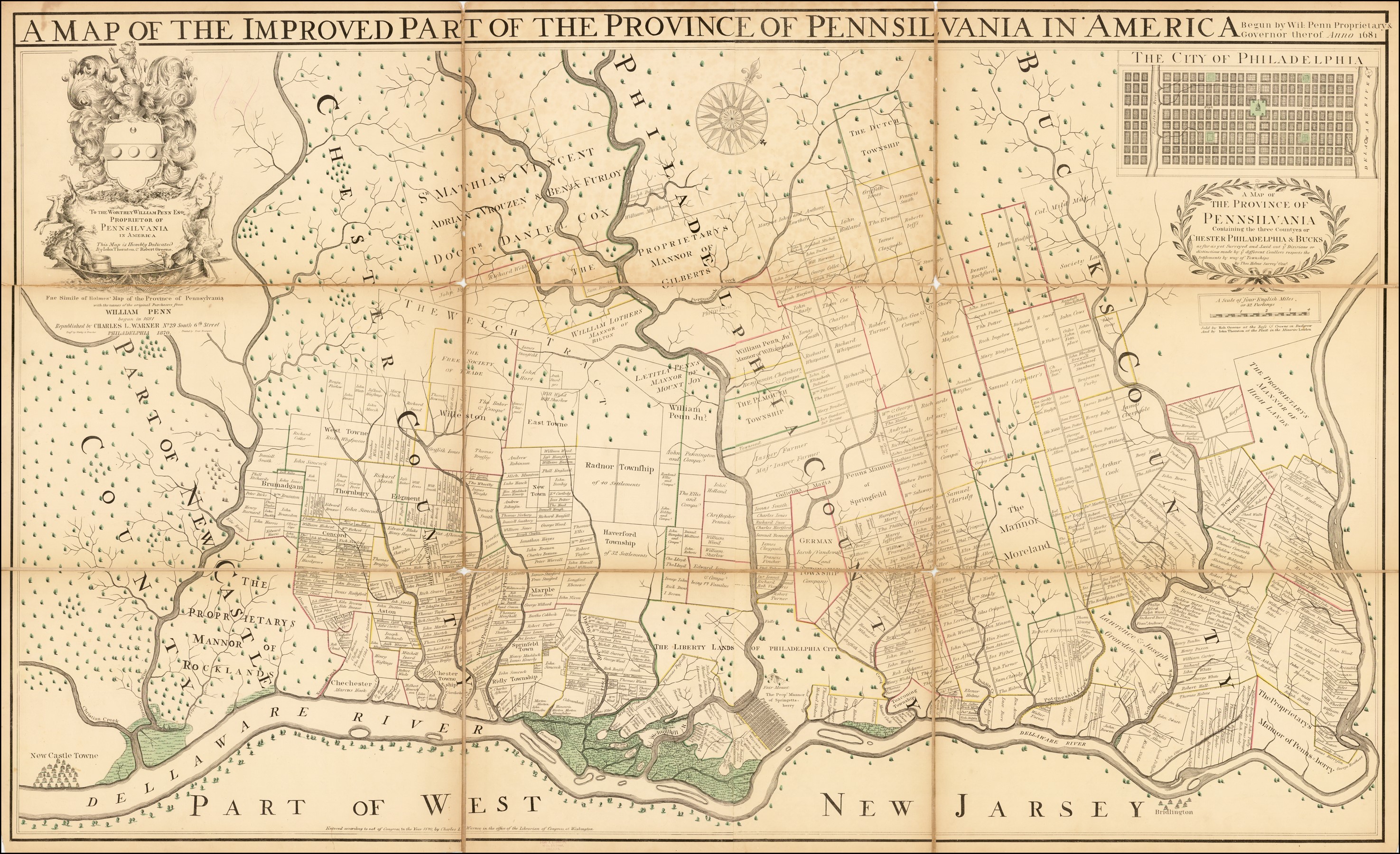
Thomas Holme’s “Map of the Improved Part of the Province of Pennsylvania”, 1695.
Rural communities in Bedford and Monroe Counties used rivers to power mills and to move commodities to other inland settlements.
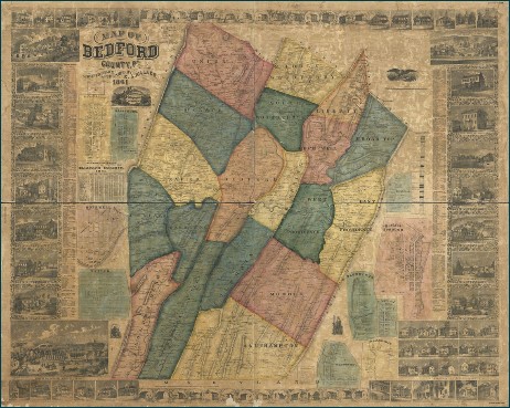
Walker’s 1860 map of Bedford County
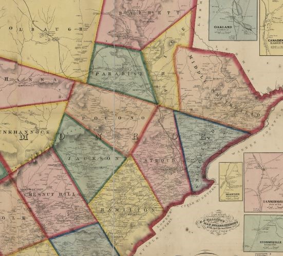
1860 Walling map of Monroe County.
Cameron County depended on the creeks and tributaries of the Susquehanna River to support local extractive industries.
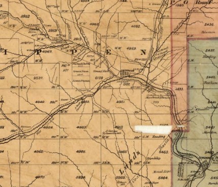
1870 map of Cameron County
While buildings associated with these industries have flooded in the past, their proximity to the water was what allowed these communities to develop and thrive. As some of those industries have changed or relocated, they have left behind flood-prone resources in search of a new use, which could leave them more vulnerable to natural disaster.
Building Types
Because the four pilot counties were selected for their geographic and architectural diversity, a range of example building types were evaluated that will be useful to other counties in the Commonwealth who decide to embark on a similar study. Philadelphia is known for its historic rowhouses situated throughout the city, but neighborhoods with similar characteristics are found in smaller cities throughout Pennsylvania.
Cameron County boasts examples of log constructed homes and steel truss bridges, while Bedford and Monroe Counties are home to a variety of building styles including bungalows, Spanish Colonial Revival, Second Empire, and Gothic Revival, just to name a few. Most buildings in each of these counties are vernacular, or built based on local needs and traditions, although many borrow stylistic elements to create their own distinctive feel.
At Risk Features
As you walk through a historic district or visit a distinctive landmark, some of the most recognizable features of the historic properties you pass might be most at risk to hazard events.
Bedford County, Londonberry Twp, 6292 Hyndman Rd.; Gravel Pit Methodist Church (current), 104738, Phase 1 photo by AECOM.
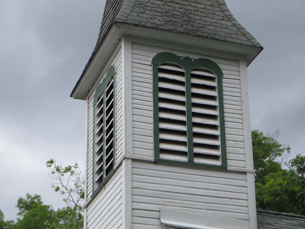
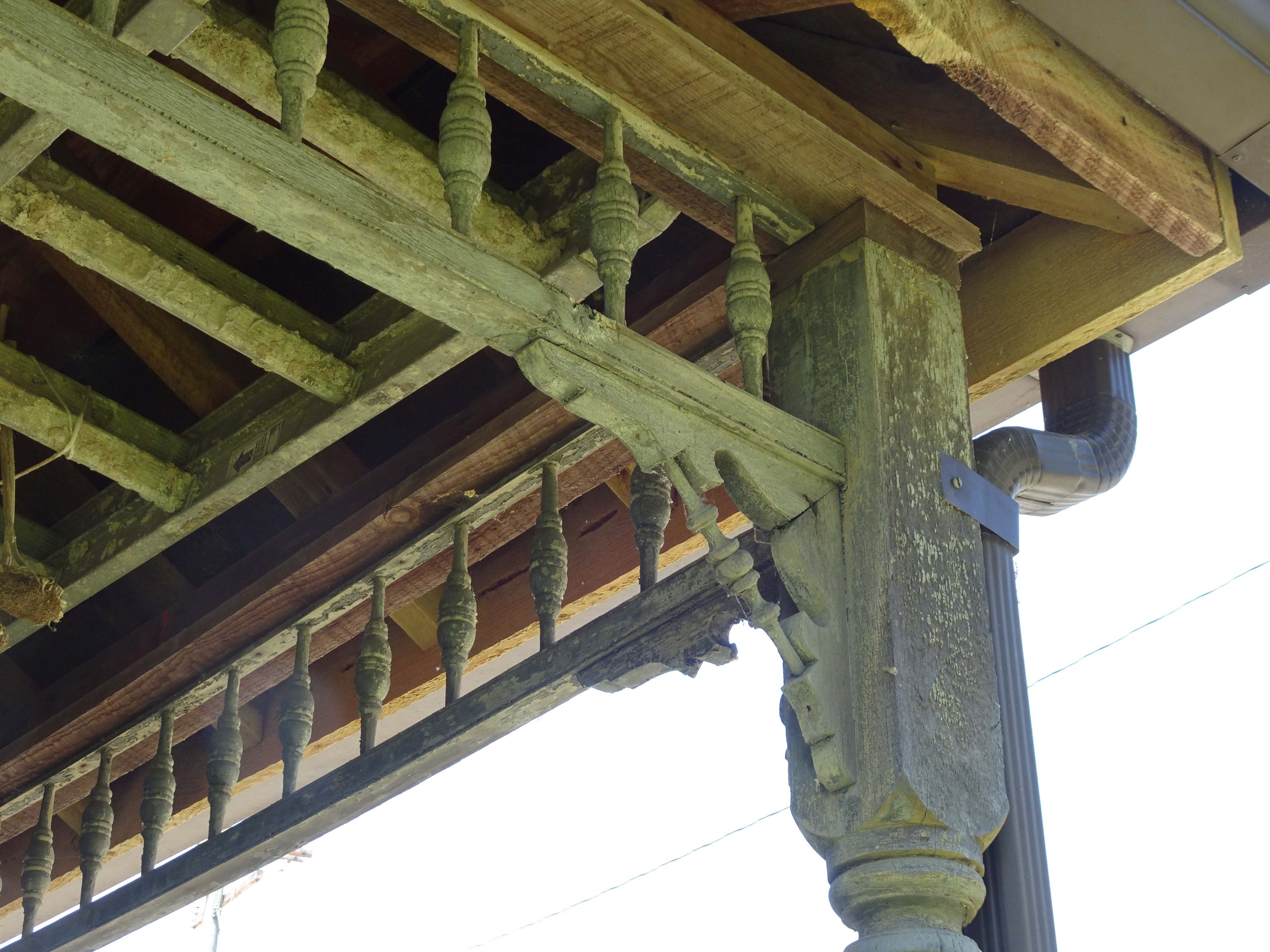
Architectural details, such as the pointed arches or towers of a Gothic Revival church or the ornate gingerbread details of a Queen Anne house, are part of what makes a historic building immediately recognizable, but these details are also frequently at risk to damage during a storm.
Cameron County, Driftwood Borough, PA-555; Barley Property, 105871.001, Phase 1 photo by AECOM.
Everything you see from a public street or sidewalk is part of a building’s exterior “envelope.”
When functioning properly, this envelope protects the building’s interior from weather and hazards, but it also absorbs the brunt of nature’s fury. For example, roof features such as a cupola or decorative eaves are at higher risk during a wind event. The wind can catch projecting surfaces and, particularly if those surfaces have not been adequately maintained and are beginning to deteriorate, break weak connections and destroy features.
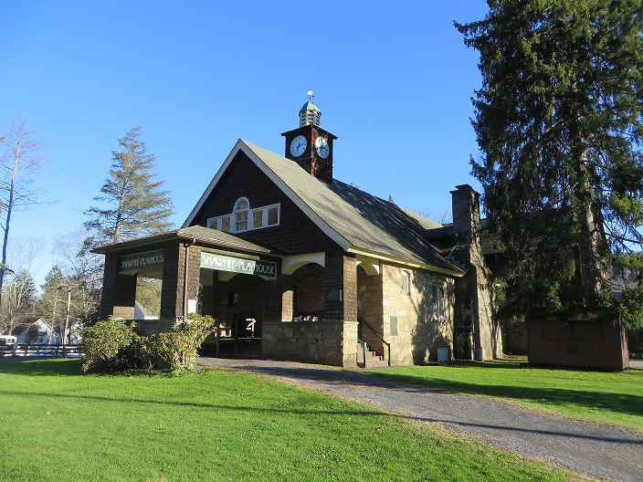
Monroe County, Smithfield Twp, 552 River Rd.; Worthington Hall; Shawnee Playhouse, 900090, photo taken by SHPO staff 2018.
Many of our historic buildings are recognizable for their brick or stone walls, and masonry surfaces are particularly at risk to freeze/thaw damage associated with winter storms.
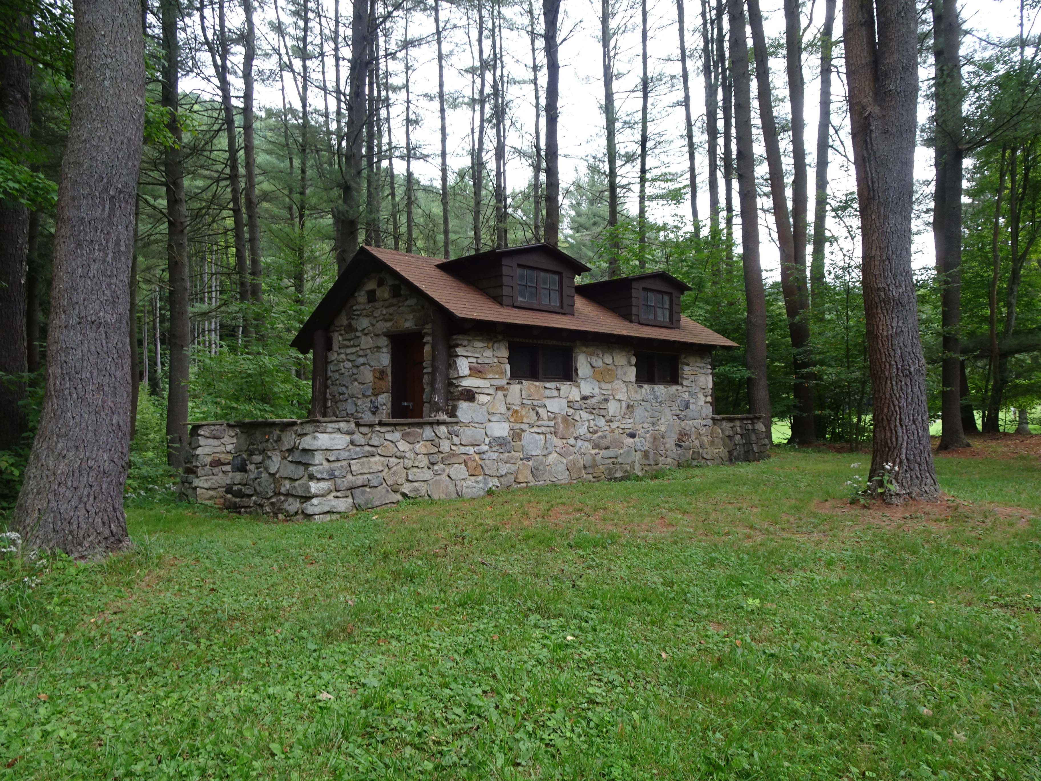
Cameron County, Portage Twp, Hemlock Rd.; CCC Public Toilets, 905034.0003, Phase 1 photo by AECOM.
Physical Context
One major consideration in identifying potential hazards involves a historic resource’s specific physical context. Location plays a key role in determining which buildings and features are at risk, and these contextual considerations were addressed throughout the development of hazard mitigation actions. A building located along a river, while most obviously being exposed to flooding, could also be at risk of wind damage because there is nothing to impede high winds blowing across the water.
Additionally, some buildings are at risk by design; they have a historic relationship with hazard sources such as rivers and creeks that itself has significance.
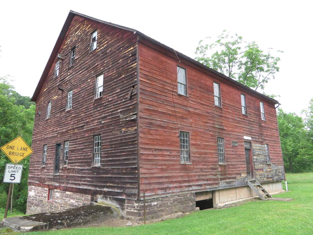
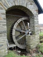
Bedford County, East Providence Twp, 627 Jackson Mill Rd.; Jackson Mills, 012149, Phase 1 photo by AECOM.
Buildings and associated features designed to be in contact with water, such as mills and their associated mechanical equipment, should not be modified in ways that will alter or eliminate that historic relationship with the water.
Philadelphia, 9600 Stenton Ave.; Pump House, 078552, Phase 1 photo by AECOM.
The final element used to evaluate potential hazards was building construction methods and materials. Many of the historic buildings in the study area are of wood construction and built on a masonry foundation. Flooding is the most common hazard in these counties, and if the foundations are not sufficiently elevated, wood components are exposed to flooding and can become saturated, increasing the risks of mold damage and rot. Steel construction can also be at risk to damage or corrosion if the exterior envelope is not properly maintained and kept water resistant.
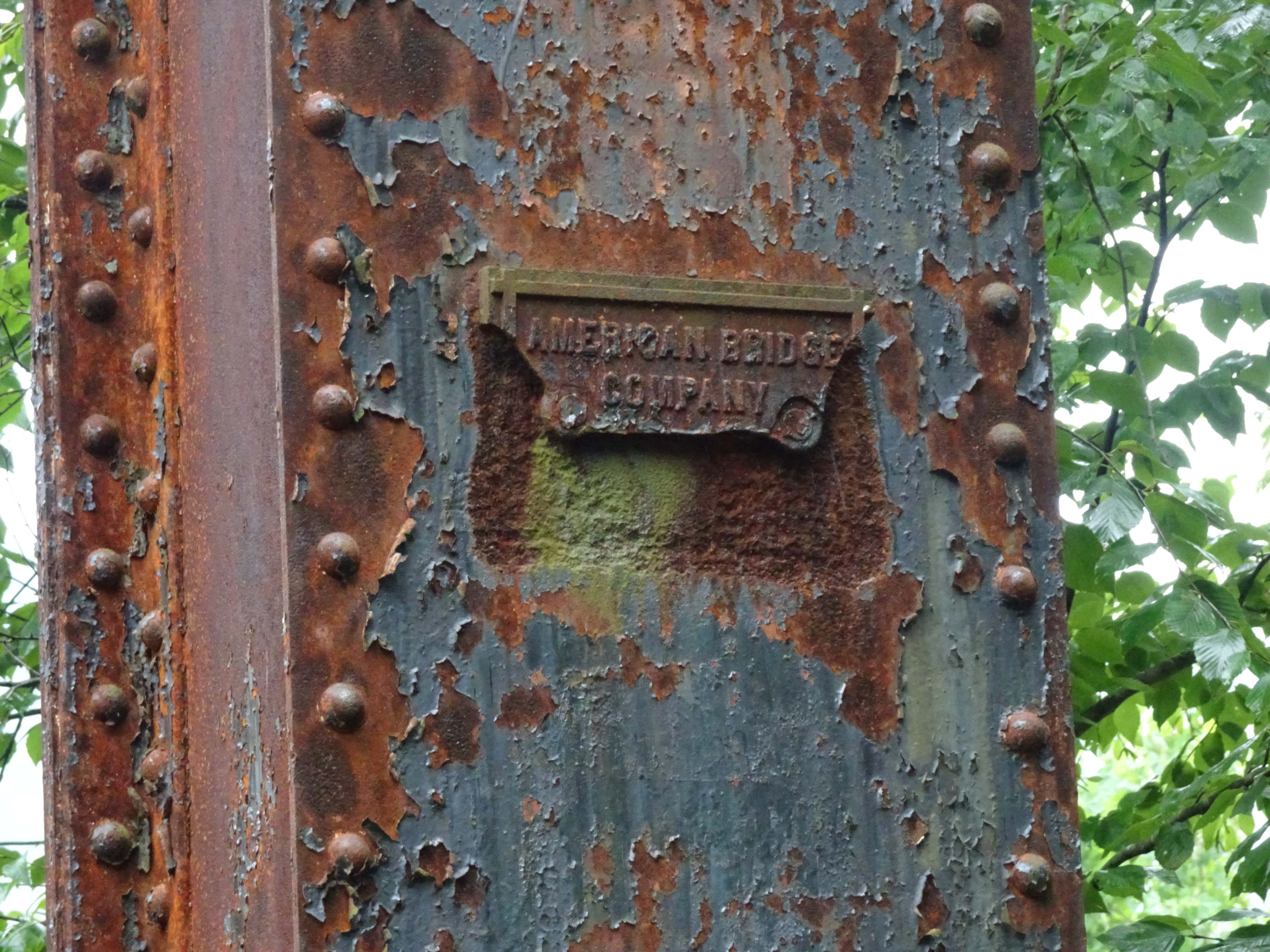
Cameron County, Gibson Twp; Sinnemahoning Valley RR/Buffalo & Susquehanna RR Bridge, 905003.0001, Phase 1 photo by AECOM.
It is important to note that, while hazards have been evaluated by probability based on their location, the effects of those hazards are not always quite so location-specific. Winter storms, hurricanes, tropical storms, and tornadoes and isolated wind events can have impacts throughout the Commonwealth. The hazard mitigation strategies developed during this project are intended to be usable by all historic and cultural resources regardless of location, and opportunities to incorporate relevant strategies should be pursued during routine maintenance and other projects.
Upcoming Event!
For those of you in the Philadelphia area, please join us on May 31st for a presentation on Phase 2 of the Disaster Planning for Historic Properties Initiative. Representatives from the Phase 2 team will be on hand to discuss the Phase 2 process and present drafts of the final hazard mitigation strategies. The history of the city’s development as it relates to natural hazard risks will also be presented, so stop by even if you just want to know more about how Philadelphia has grown over time.
Meeting Time and Location
Thursday, May 31, 2018
4pm-6pm
Lloyd Hall
1 Boathouse Row,
Philadelphia, PA 19130
This week’s post was written by Ashley Samonisky of Vision Planning & Consulting, LLC. Ms. Samonisky is a project manager and lead planner for Vision Planning and Consulting. She has over seven years of emergency management and planning experience including: hazard mitigation, preparedness planning, GIS, public outreach and education. She serves as project manager on cultural resource/hazard mitigation projects. Ms. Samonisky prepares mitigation, preparedness, and recovery plans for communities throughout the Mid-Atlantic. Ms. Samonisky received her Bachelor’s in Emergency Management from Maryland and completed a second Bachelor’s from Salisbury University in Geography. She currently serves on the Maryland State Geographic Information Committee (MSGIC) as the Outreach Sub-Committee Chair.
I am beginning my final project for my Master’s degree in Emergency and Disaster Management, and my topic is mitigation and historic preservation. The information provided in your Disaster Planning for Historic Properties Initiative has been very helpful. Although my specific area of focus is the Historic District of Key West. Florida, many of the examples and conditions described in your document also apply to those in Key West. Thank you for your work.