by Emily Paulus Everett, AECOM Technical Services
On November 6, 2015, the City of Philadelphia became the first United States city to join the Organization of World Heritage Cities – a prestigious designation that recognizes, among other things, its vast and significant collection of well-preserved historic resources. That same week, representatives from the PA SHPO, US Army Corps of Engineers (USACE), Philadelphia Office of Emergency Management, and AECOM Technical Services, Inc. gathered in Center City, Philadelphia to kick off Phase 1 of a two-phase effort to protect those historic resources before, during, and in the aftermath of, future flooding events. As part of the PA SHPO’s Disaster Planning for Historic Properties Initiative, Philadelphia County joins Monroe, Bedford, and Cameron as one of four pilot counties to take into account the impact of future flooding events on historic properties.
In the most urban and densely populated county of the four pilot areas, this project is vital. Climatologists tell us that rainfall and snowmelt affects urban areas very differently than rural ones because much of the land surface is covered by roads and buildings and there is less overall absorption coupled with more rapid runoff. When combined with the dense, layered built environment and urban infrastructure of a large city, the impact of a serious flooding event on historic buildings has the potential to be catastrophic. Thus, having an accurate, up-to-date inventory of historic resources in vulnerable areas is key to an informed and quick response when disasters strike and can also aid in promoting both physical and social resilience in their aftermath.
Mapping the City
Staff at the PA SHPO generated the initial data set that would become the work plan for the project by overlaying listed or contributing resources in the Philadelphia Register of Historic Places (PRHP) and in the publicly accessible Cultural Resources Geographic Information System (CRGIS) on a layer of various flood inundation zones in GIS. The final analysis revealed that Philadelphia’s flood zones contain nearly 600 registered historic properties. A registered property is one that is listed on the National Register of Historic Places (including National Historic Landmarks) or the PRHP, or that contributes to a National Register or Philadelphia Register Historic District.
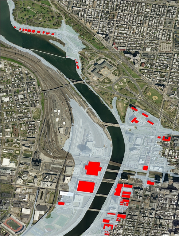
An AECOM GIS map showing registered properties within the flood zone in red along the Schuylkill River (note boathouse row in the upper left-hand corner). A registered property is one that is listed on the National Register of Historic Places or the Philadelphia Register of Historic Places, or that contributes to a National Register or Philadelphia Register Historic District.
Once mapped, three distinct concentrations of registered historic properties became evident, illustrating an essential nexus between flooding and historic preservation: that early historic settlements are often found near waterways. Indeed, the first concentration is along the Schuylkill River toward Center City, where the establishment of maritime trades, manufacturing, and associated workers housing developed throughout the 18th and 19th centuries. The second area, the Philadelphia Naval Shipyard, is situated along the Delaware River at the city’s south end and contains historic resources associated with naval vessel construction and repair. Finally, the third concentration is found along the north Schuylkill banks, where the milling industry and accompanying workers housing established neighborhoods such as Manayunk and East Falls. The building types found in these areas run the gamut from modest workingman’s rowhouses to industrial loft to International Style apartment buildings and nearly everything in between.
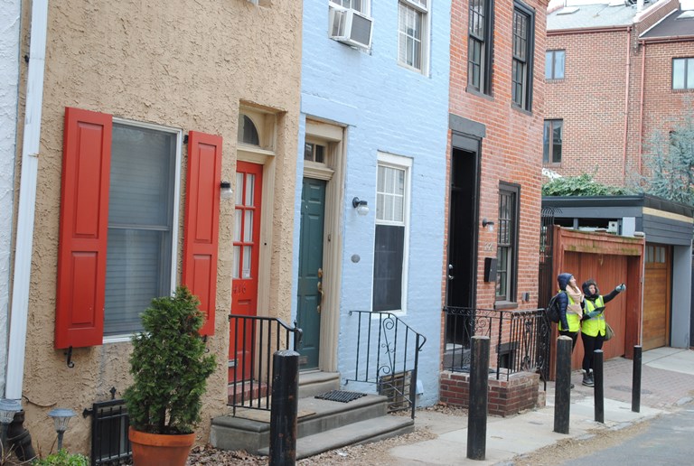
AECOM team members evaluating rowhouses on Manning Street in the Ramcat/Schuylkill Historic District.
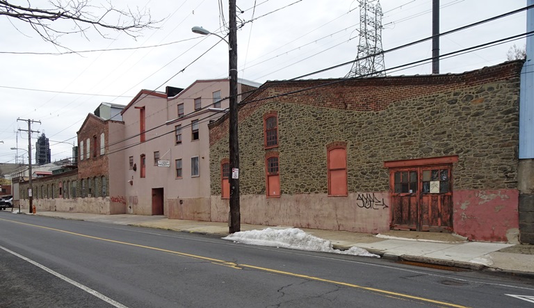
View along the flood-prone southern end of Main Street in the Manayunk Historic District, showing the G.J. Littlewood & Sons complex. G.J. Littlewood & Sons has been in operation for more than 140 years, specializing in dyeing of natural fibers.
Next, AECOM’s GIS Team imported shapefiles for the registered historic properties along with the flood hazard area layers into Fulcrum – a cloud-based mobile data collection platform – so that surveyors could reference the GIS maps in the field as well as capture data via hand-held tablets. Fulcrum was equipped with a special Disaster Planning for Historic Properties Data Form, which was used to capture flood-prone architectural details and character-defining features for each property. The data forms will serve to both update existing records and present information in a methodical, searchable, and consistent manner. As of this writing, field survey is nearly complete and the project team will begin finalizing the data forms and photographs for review by the PA SHPO.
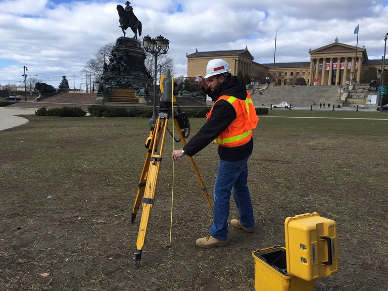
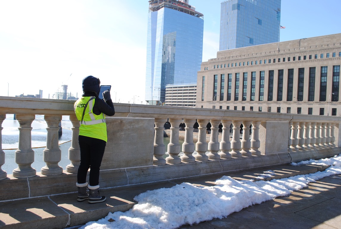
USACE Team Leader Matthew Tuttle captures building elevation data in front of the Philadelphia Art Museum.
Meanwhile our project partners at the USACE, led by Matthew Tuttle, Land Survey Party Chief, have also been hard at work since early January recording building elevation measurements for each property. They use a GPS antenna/receiver set-up that allows them to determine the exact elevation of the first floor and adjacent grades of the buildings, for use in understanding where water would enter the building during a flooding event. According to Mr. Tuttle, “we have completed first floor flood studies in the past, but none have had the historical impact that these sites have had. This project has been special to us in that we have learned very interesting history from the locals and historians at almost every site. We are honored to help protect, preserve and help bring some of the lesser known, but extremely important sites to light!”
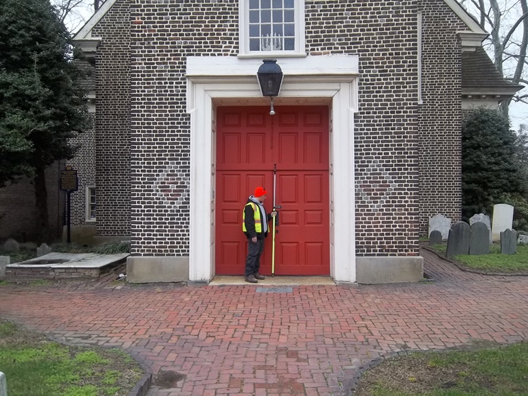
USACE team member Nick Spina installs survey reference points in front of the ca. 1700 Gloria Dei Church – a National Historic Site.
Water, Water Everywhere
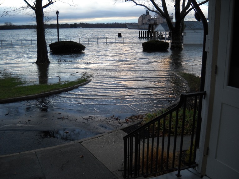
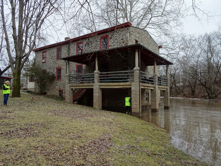
Reminders of the need for this study were seemingly at every turn throughout the course of the field survey, from the presence of high water marks to evidence of water damage and decay. On the morning of February 4th, following a period of rain and snow melt, surveyors even happened upon minor flooding while surveying the Philadelphia Canoe Club. Housed in a former 18th century stone mill within the Fairmount Park System, the Philadelphia Canoe Club is located at the confluence of Wissahickon Creek and the Schuylkill River. Surveyors were invited onto the property to view the building’s riverside elevation and visit the interior, where accommodations such as furniture on wheels and handcrafted canoes hanging from ceilings are made. Likewise, at the Fairmount Water Works, surveyors were given a behind-the-scenes tour of the esplanade and river-facing portion of the complex by Building Manager Garrett Selby, who pointed out vulnerable areas.
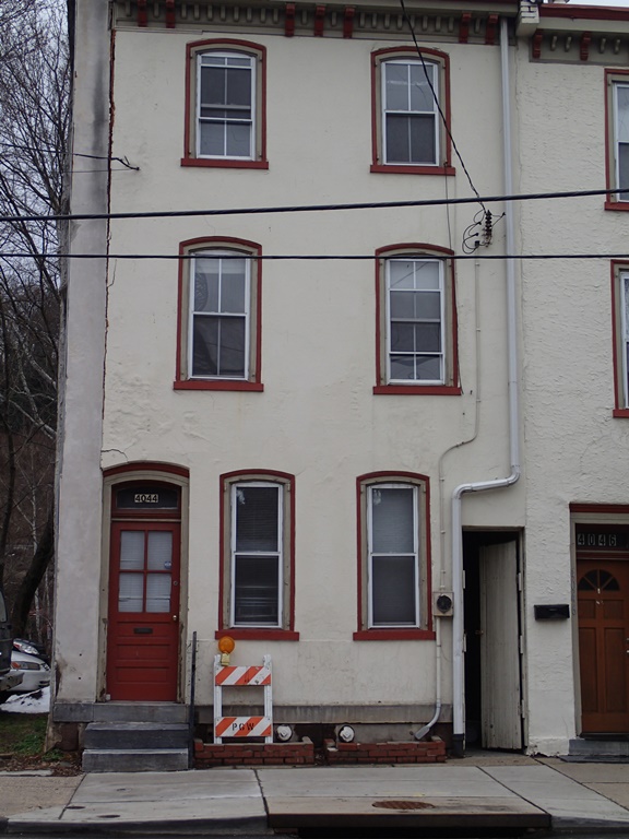
A flood-damaged, vacant rowhouse on the south side of Main Street in the Manayunk Historic District.
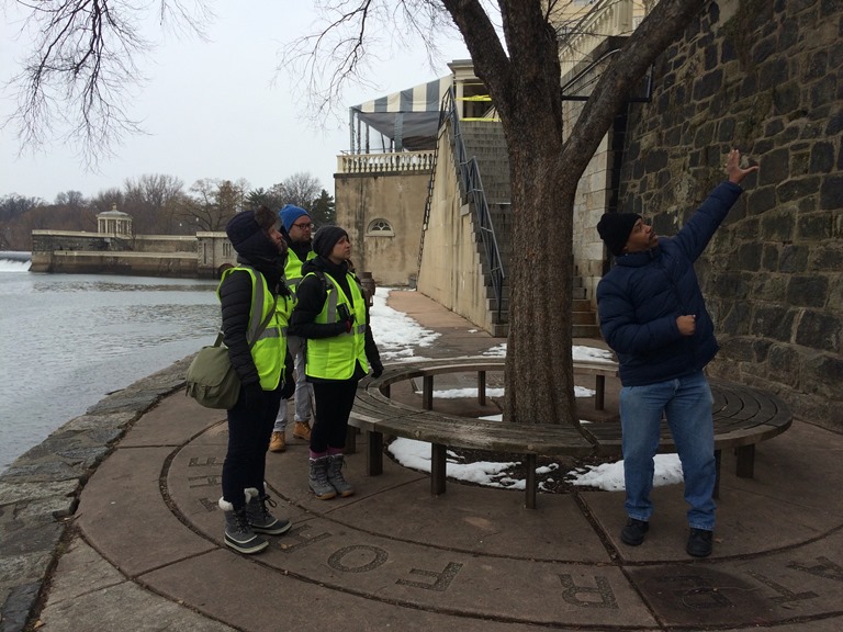
Fairmount Water Works Building Manager Garrett Selby pointing out high water areas to AECOM team members Nicole McKairnes, Samantha Kuntz, and Benjamin Buckley.
Surveyors were also treated to a tour of the long-shuttered Kelly Natatorium within the water works facility, which has been closed since 1972 when it was flooded by Hurricane Agnes! Beth Beatty, Executive Director at Fort Mifflin, a National Historic Landmark where flooding is routine, points out that “the Fort was built on Mud Island, the location identified as a “muddy island almost drowned at high tide” on an engineer’s map circa 1777, so we have been battling our location for over 200 years!” One of the most tangible aspects of this project has been the stories graciously shared by property and business owners along the way, giving surveyors a glimpse of the unique challenges they face due to their location in a floodplain. Thankfully, Phase 2 of this project will bring historically-sensitive mitigation solutions to reduce the flood risk to these irreplaceable resources.
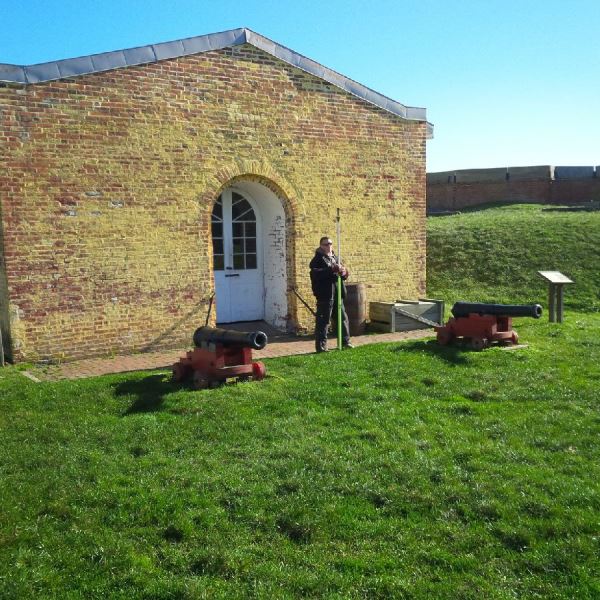
USACE team member Nick Spina recording building elevation data at Fort Mifflin – a National Historic Landmark.
Look for AECOM’s follow-up blog post in April, which will present progress of non-disaster related survey work in the Lower Northwest and North Delaware plan districts in Philadelphia, slated to begin later this month!
Emily Paulus Everett is a Senior Architectural Historian for AECOM Technical Services, Inc. with over 15 years of historic preservation planning experience throughout the Mid-Atlantic and New England Regions. Based in AECOM’s Cultural Resources Department in Burlington, New Jersey, she serves as the Survey Team Leader for the PA SHPO’s Disaster Planning for Historic Properties Phase 1 (historic resource survey) project in Philadelphia. Ms. Everett earned an M.A. in Historic Preservation from the University of Delaware and has worked as an Architectural Historian for both the District of Columbia and New Hampshire State Historic Preservation Offices.
Comment Policy
PHMC welcomes and encourages topic-related comments on this blog. PHMC reserves the right to remove comments that in PHMC’s discretion do not follow participation guidelines.
Commenters and Comments shall be related to the blog post topic and respectful of others who use this site.
Commenters and Comments shall not: use language that is offensive, inflammatory or provocative (this includes, but is not limited to, using profanity, obscene, or vulgar comments); disparage other commenters or people; condone illegal activity; identify the location of known or suspected archeological sites; post personal information in comments such as addresses, phone numbers, e-mail addresses or other contact details, which may relate to you or other individuals; impersonate or falsely claim to represent a person or an organization; make any commercial endorsement or promotion of any product, service or publication.
If you would like to comment on other topics not related to this blog post but related to PHMC, please fill out the PHMC Contact Us Form.
Excellent insight on a timely and challenging topic. I will be interested to learn more about this and the implication for other historic buildings in flood plains.
Historic properties really are a pride to one’s country. It’s a relief that authorities have taken action to try to protect them when inevitable disasters come.