“This bridge will triumphantly typify the trail-blazing strategy…” so said Pennsylvania Governor John S. Fine in 1954 about the soon to be constructed Hawk Falls Bridge, finishing with “that took the Pennsylvania Turnpike System across streams of great width and turbulence…and through the rocky cores of mighty mountains.”
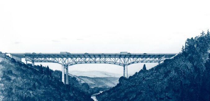
Undated illustration of the original Hawk Falls Bridge. The conceptual design was by Modjesky and Masters. Courtesy of the Pennsylvania Turnpike Commission.
The Pennsylvania Turnpike was the first of its kind and received nationwide acclaim as an engineering marvel. Pennsylvania Governor George Earle, on May 21, 1937, signed Act 211, which authorized the creation of the Pennsylvania Turnpike Commission (PTC). By October 1, 1940, the original 160-mile turnpike was complete. Today it stretches more than 550 miles, triple its original length.
The Northeastern Extension, a 110-mile route from Montgomery County to Lackawanna County broke ground on March 25, 1954. As with the original turnpike, the landscape of Pennsylvania provided some challenges such as mountainous terrains and deep creek valleys, especially the Blue Mountains and the Pocono Mountains region.
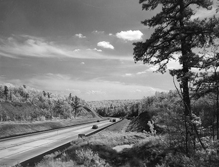
This scenic photo along the Northeastern Extension was used to illustrate a New York Times travel feature about the Turnpike’s 25th anniversary in 1964 stating that the roadway is “the first of the great modern toll routes, [and] grows older and broader.” PTC, https://paturnpike.com/about-us/turnpike-history/interactive-timeline.
This scenic photo along the Northeastern Extension was used to illustrate a New York Times travel feature about the Turnpike’s 25th anniversary in 1964 stating that the roadway is “the first of the great modern toll routes, [and] grows older and broader.” PTC, https://paturnpike.com/about-us/turnpike-history/interactive-timeline.
About the Hawk Falls Bridge
While you may be enjoying the sights and sounds of nature as you travel along the turnpike, you may not have realized you just crossed over a monumental bridge, however visitors to Hickory State Park have had a different perspective of the Hawk Falls Bridge for the last sixty-six years.
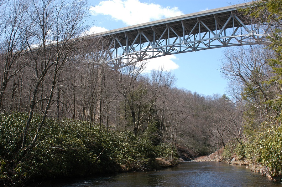
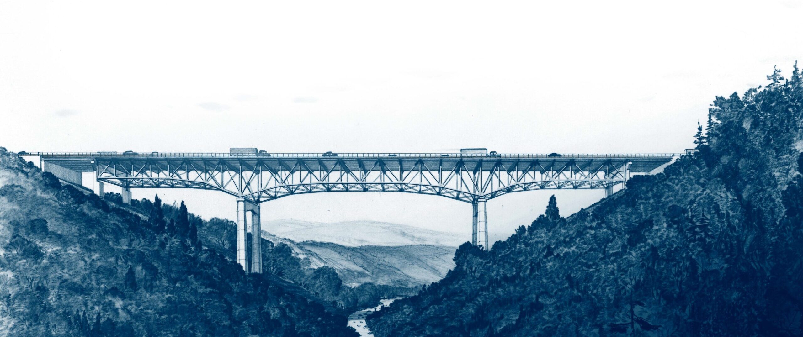
View of the existing Hawk Falls Bridge looking west. Courtesy of the PTC, https://www.paturnpike.com/traveling/construction/site/milepost-a89-hawk-falls/design-construction-details.
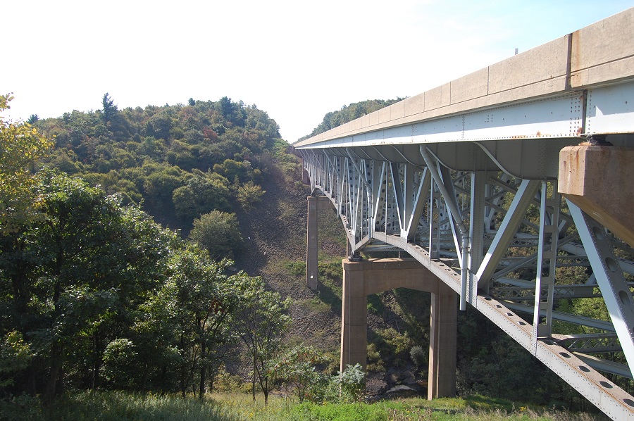
The existing Hawk Falls Bridge, looking south. Courtesy of PTC https://www.paturnpike.com/traveling/construction/site/milepost-a89-hawk-falls/design-construction-details.
The bridge consists of a 738-foot, three-span, continuous deck truss, with a single-span I-beam approach at each end. It was one of the tallest bridges on the Pennsylvania Turnpike system, with its road surface approximately 195 feet above Mud Run.
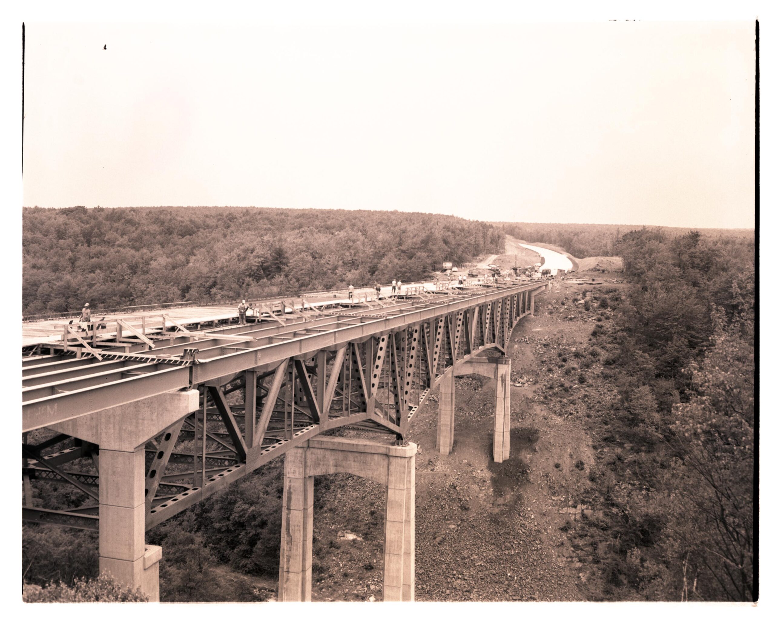
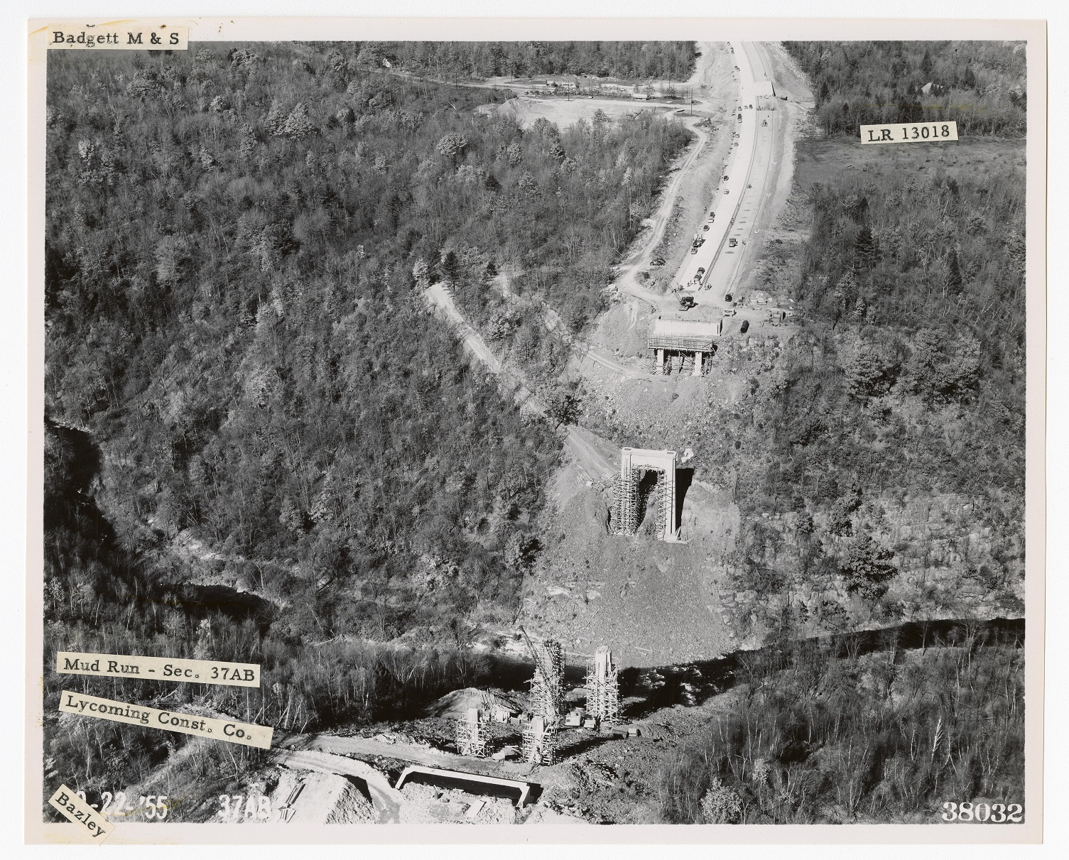
View of the Hawk Falls Bridge under construction. The image is from July 26, 1956. Courtesy of the Pennsylvania State Archives, PTC RG 029.
The Pennsylvania State Historic Preservation Office (PA SHPO) in consultation with the Pennsylvania Turnpike Commission, determined that the Hawk Falls Bridge is eligible for listing in the National Register of Historic Places (NRHP) under Criterion C for Engineering, as a significant example of mid-twentieth-century bridge engineering that deviated from the standard bridge designs used by the Pennsylvania Turnpike Commission.
Throughout the Northeastern Extension, the majority of the turnpike bridges were a combination of girder, T-beam, or stringer structural systems. Only two, the Pohopoco Creek Bridge (Bridge NB-526, since replaced) and the Hawk Falls Bridge (Bridge NB-610) were designed with continuous deck truss spans.
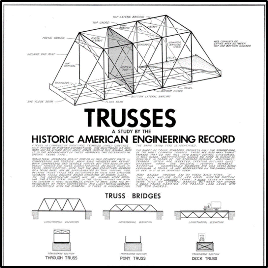
An image of the poster for Trusses: A Study by the Historic American Engineering Record National Park Service, Arnold David Jones, 1976, HAER TI-1, loc.gov/pictures/item/97515080, edited for emphasis.
A truss bridge is constructed by joining smaller connecting elements to form triangular units. These units form a rigid structure that transfers the load from a single point to wider area, creating appealing bridges with attention grabbing designs. There are three types of trusses – through, pony and deck. A continuous deck truss bridge can carry heavy traffic loads and accommodate long spans, as was needed to cross the Mud Run gorge.
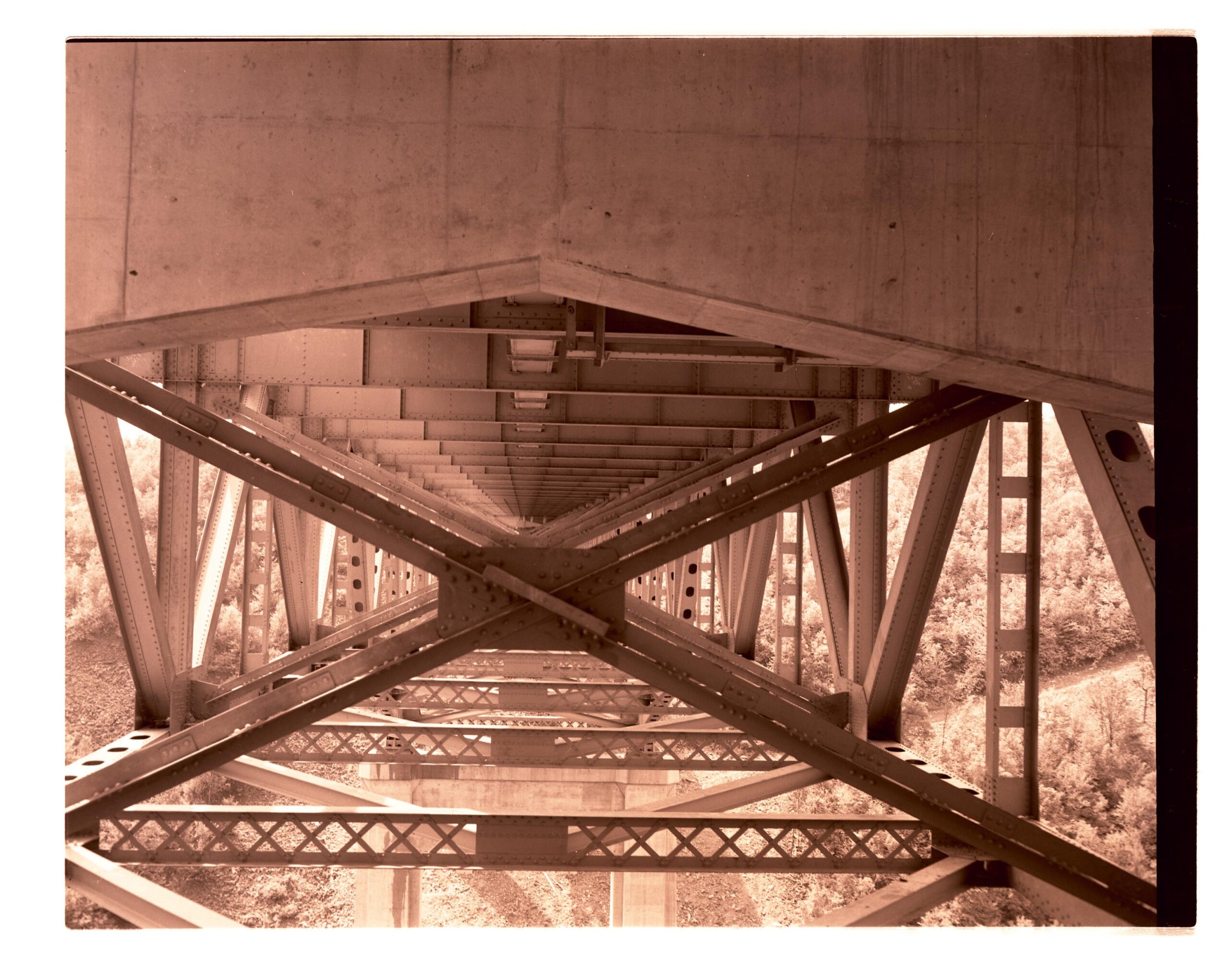
A view of the deck truss of the Hawk Falls Bridge from July 26, 1956. Courtesy of the Pennsylvania State Archives, PTC RG 029.
A deck truss bridge is characterized by a roadbed constructed on top of the truss. Deck trusses are generally used when the span exceeds 80 feet and there is sufficient vertical clearance for the bridge trusses to be underneath the roadway.
Replacing the Hawk Falls Bridge
After more than 60 years of service, the Hawk Falls Bridge was determined to have exceeded its useful service life and the PTC ultimately decided to replace the Hawk Falls Bridge with a new steel arch bridge.
The proposed turnpike project to replace the Hawk Falls Bridge required a Department of the Army Clean Water Section 404 permit and the U.S. Army Corps of Engineers (USACE) was the responsible federal agency issuing the permit. As a federal undertaking, consultation under Section 106 of the National Historic Preservation Act occurred between the USACE, PA SHPO, PTC and other consulting parties, as federal agencies must consider the effect of their projects on historic properties which are defined as resources listed in or eligible for listing in the NRHP.
The two historic properties in the project area included the Hickory Run State Park Recreational Demonstration area and the Hawk Falls Bridge, both eligible for the NRHP. The proposed project had the potential to adversely affect the historic bridge, and thus as part of the process, consideration had to be given to alternatives that avoided or minimized effects. The PTC submitted bridge inspection reports, alignment studies, and rehabilitation feasibility reports that examined if the bridge rehabilitation project could be designed to meet the Secretary of the Interior’s Standards for the Treatment of Historic Properties (the Standards).
Based upon all the documentation; the finding that even if the bridge was successfully rehabilitated/reconstructed, it would remain fracture-critical and not meet the project purpose and need. Efforts to avoid or minimize the adverse effect thus had been considered, and USACE determined that there was no alternative to demolition. Consultation continued and concluded in the signing of a Memorandum of Agreement that stipulated the mitigation that would resolve the adverse effect, documenting the bridge and its significance in an interpretive panel, creation of a content for digital public education in the form of a website materials, Hawk Falls Bridge Fact Sheet, and this blog post.
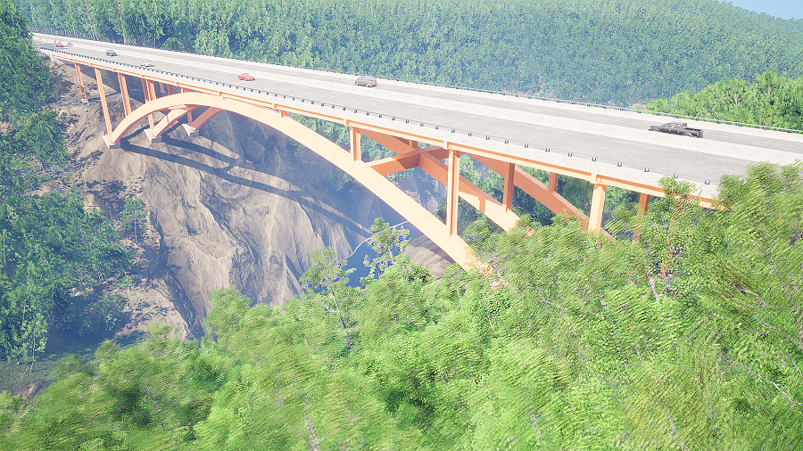
A rendering of the new Hawk Falls Bridge to be completed by the year 2025. Courtesy of the PTC.
The replacement Hawk Falls Bridge will be a 720′-long steel structure featuring a 480′ deck arch span flanked by four 60′ deck plate girder spans. As with the current bridge, the new bridge will carry two traffic lanes in each direction, but it will also provide 12′ wide outside shoulders and 6′ wide median shoulders. Three welded, steel box arch ribs will be utilized to create an aesthetically pleasing structure that spans the deep Mud Run Valley located within Hickory Run State Park.
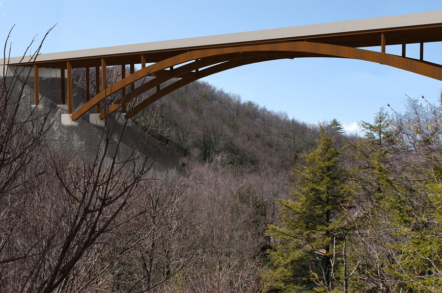
Rendering of the new Hawk Falls Bridge. Courtesy of the PTC.
Comment Policy
PHMC welcomes and encourages topic-related comments on this blog. PHMC reserves the right to remove comments that in PHMC’s discretion do not follow participation guidelines.
Commenters and Comments shall be related to the blog post topic and respectful of others who use this site.
Commenters and Comments shall not: use language that is offensive, inflammatory or provocative (this includes, but is not limited to, using profanity, obscene, or vulgar comments); disparage other commenters or people; condone illegal activity; identify the location of known or suspected archeological sites; post personal information in comments such as addresses, phone numbers, e-mail addresses or other contact details, which may relate to you or other individuals; impersonate or falsely claim to represent a person or an organization; make any commercial endorsement or promotion of any product, service or publication.
If you would like to comment on other topics not related to this blog post but related to PHMC, please fill out the PHMC Contact Us Form.
0 Comments
1 Pingback