Over the last year, architectural historians and survey engineers with Commonwealth Heritage Group and ASC Group have been documenting historic properties and communities in Dauphin, Cumberland, and Perry Counties.
At the same time, staff from Johnson, Mirmiram, & Thompson have been doing similar work in Juniata County.
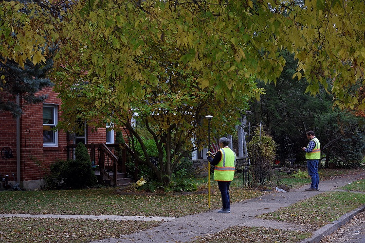
Disaster Planning Initiative
These survey projects were undertaken as part of PA SHPO’s Disaster Planning for Historic Properties Initiative, which has been funded by a grant from the National Park Service to provide for repairs and address planning deficits following the devastation of Hurricane Sandy in 2012.
PA SHPO has used some of this funding to survey properties at risk of future flooding in a total of eight counties now. However, the Central PA survey projects benefited from lessons learned in earlier survey efforts in one important way: they prioritized a more holistic focus on communities.
Central PA Approach
Rather than simply identifying every building over 50 years old at risk of flooding in the four central counties (which we realistically didn’t have funding for), PA SHPO worked with the consultants to identify the specific communities in each county whose character might most be at risk and for which we had very little information.
For the purpose of these projects, “community” could refer to a small village, a borough, or a neighborhood in Harrisburg.
Previous blog posts have addressed some of these communities: Lykens in Dauphin County; Blain in Perry County, and Mount Holly Springs in Cumberland County.
This post will highlight a few of the other communities we learned about through these projects.
Mexico, Juniata County
Today, Mexico is a village of less than 500 people in Walker Township, one of five communities surveyed in Juniata County.
Settled in the early 19th century, Mexico grew into a small community along the Juniata River and William Penn Highway, which was originally a turnpike road leading to Lewistown. By mid-19th century, the village included between 30 and 40 houses, a few stores, three taverns, two churches, a school and a grist mill, sawmill, and wool factory.[1]
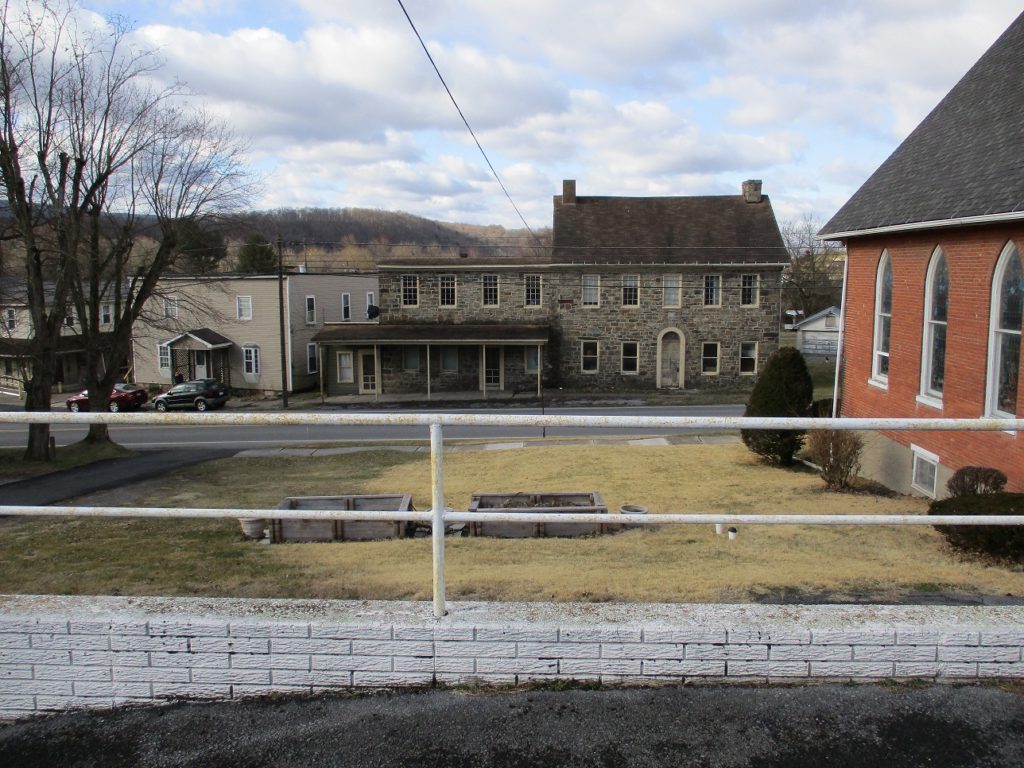
Most of the 38 properties surveyed are clustered along the William Penn Highway and date from the early to mid-nineteenth century, though a few were built as late as the 1940s.
Harrisburg’s Riverside neighborhood, Dauphin County
Founded in 1905 north of Harrisburg, Riverside is an economically diverse suburb annexed by the city in 1917.
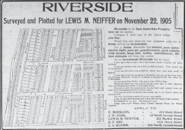
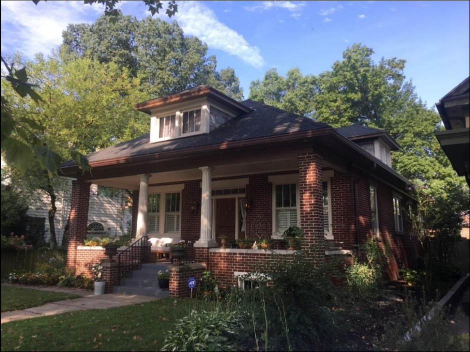
Unlike earlier neighborhoods, Riverside is home to a wide array of housing types providing housing for both the working class and wealthier families.
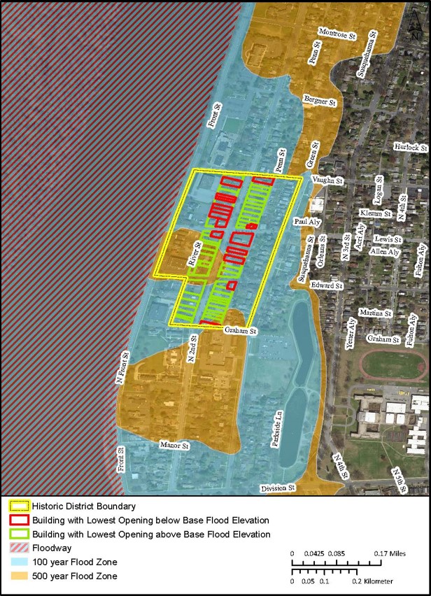
Since this project was specifically focused on communities at risk of flooding, Commonwealth produced maps showing the impact of flooding on the surveyed community.
In Riverside, 101 properties were individually surveyed along the 2nd Street Corridor. Of those, 85 are in the Special Flood Hazard Area (an area with a 1% chance of flooding per year), and 29 have visible openings below the Base Flood Elevation (the height floodwaters are likely to reach in a 1% probability flood), making them particularly susceptible to damage from future flooding.
Harrisburg Area Community College, Dauphin County
The Harrisburg Area Community College (HACC) represents a different kind of community and a different period of time than the other surveyed areas.
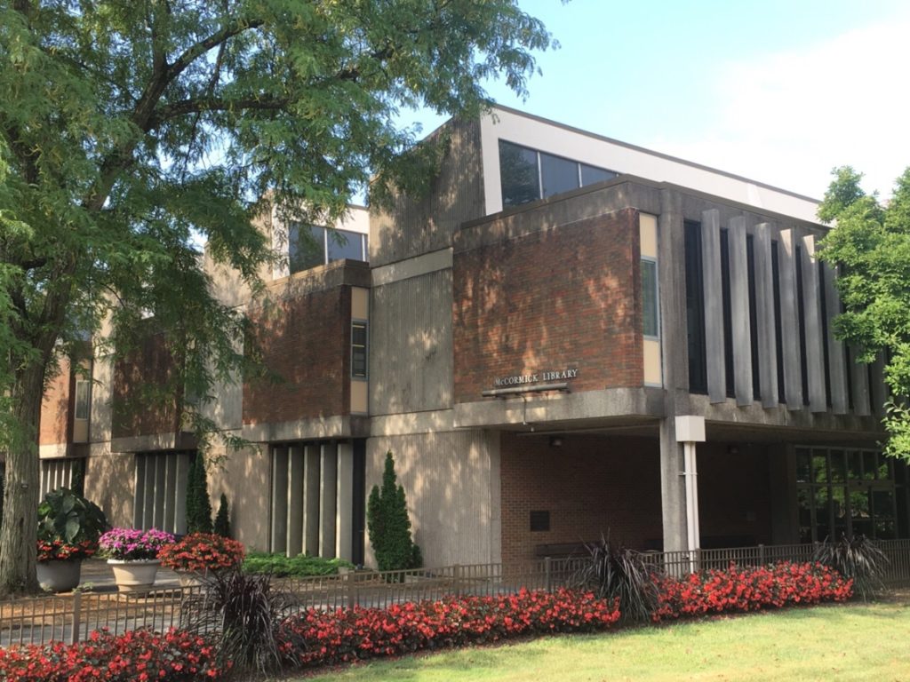
Designed by the firm William Lynch Murray and Associates, the first phase of building this mid-century modern campus was completed between 1968 and 1975.
Most of HACC’s campus is within the Special Flood Hazard Area, including the historic core which contains the oldest buildings on campus.
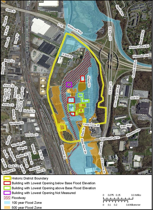
The last few months have illustrated for many of us just how valuable dedicated space for education is, but the long-term accessibility and affordability of this campus is at risk from increased flooding in the future.
Context Matters
Our approach in these four counties might sound like a simple change in procedure, but the hope is that a represents a more concerted focus on maintaining and safeguarding a strong sense of place in our historic communities.
Context matters. Understanding risk to a single home or business in the context of what the loss of that home or business might mean to the community it contributes to and the people who value it gives us a better understanding of the true risks of future flooding.
[1] Rupp, I. Daniel. History and topography of Northumberland, Huntingdon, Mifflin, Centre, Union, Columbia, Juniata and Clinton Counties, Pa. (Lancaster, Pa.: G. Hills, 1847), 343.
Comment Policy
PHMC welcomes and encourages topic-related comments on this blog. PHMC reserves the right to remove comments that in PHMC’s discretion do not follow participation guidelines.
Commenters and Comments shall be related to the blog post topic and respectful of others who use this site.
Commenters and Comments shall not: use language that is offensive, inflammatory or provocative (this includes, but is not limited to, using profanity, obscene, or vulgar comments); disparage other commenters or people; condone illegal activity; identify the location of known or suspected archeological sites; post personal information in comments such as addresses, phone numbers, e-mail addresses or other contact details, which may relate to you or other individuals; impersonate or falsely claim to represent a person or an organization; make any commercial endorsement or promotion of any product, service or publication.
If you would like to comment on other topics not related to this blog post but related to PHMC, please fill out the PHMC Contact Us Form.
Show me a map for Renovo Pa 17764 !!! I can’t find it on your website !!
I need a new flood zone map for Renovo Pa.17764 !!