The BHP launched the Pennsylvania’s Historic Suburbs website in September 2010. The first installment focuses on post World War II housing developments.
Our main goal is to present an online toolkit that provides information and avenues of research. The website “The Researcher’s Guide
for Developing a Context for Evaluating Post World War II Suburbs for National Register Eligibility” needs to be applicable across the state. This material provides specific questions that can be applied to these resources for documentation and evaluation purposes, identify property types and character-defining features general overviews of the trends, themes and events of the time period; and, relevant, publicly-accessible, online resources such as historic and modern aerial maps, census data, and tax records.
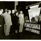
Pennsylvania Week, October 10-17 1954, a Pennsylvania Department of Commerce sponsored event. Photo courtesy of the Pennsylvania State Archives
While postwar suburbs reflect a more general, national pattern, we felt it was necessary for the researcher to understand them more clearly as part of regional and/or local pattern of development.Regional considerations must be taken into account due to the comprehensive range of geographic, socio-political, economic and demographic patterns of development that the postwar period exhibited in Pennsylvania.
Although the population remained virtually stagnant between 1945 and 1975, the number of housing units in the state tripled, from about 1.5 million in 1940 to almost 5 million in 1975. The period saw tremendous relocation of population away from urban cores and rural counties to concentrate in suburbs around boroughs and cities. It also saw a major shift of population to the southeast quadrant of the state, outside of Philadelphia, in the sphere of the growing New York-DC megalopolis. In addition, the state’s economy went from a post-war industrial boom in the 1950s to the traumatizing bust of the 1970s, with accompanying restructuring of local economies and emergence of re-development schemes that dramatically affected residential patterns.
We want researchers to ask questions such as:
- What role, such as zoning changes and creation of infrastructure, did the borough or township play in these developments?
- Why was new housing needed, and were the creators of the subdivisions trying to solve problems more serious than selling houses?
- Are there areas in the township outside of the city that experienced similar residential development, particularly residential development for people working in the city?
- Did the community specifically exclude African Americans or other ethnic or religious groups?
- Was there a biracial group or committee involved in the subdivision development?
- Who were the developers behind these residential developments and what construction/business strategies did they adopt?
Researchers also need to document how postwar development impacted the environment . Rampant postwar subdivision construction presented an opportunity for municipalities to discuss how to preserve open space and control growth. These concerns precipitated the 1968 enactment of the state’s Municipalities Planning Code act which provided authority for local, county and regional community planning in Pennsylvania.
The impact of municipal planning and the widespread establishment of municipal services, such as garbage pickup and public sewer/water, have interestingly also presented consequences for archaeological research at sites dating to the postwar period. These types of municipal services have reduced the presence of middens, privies and wells, which are some of the most productive feature types and artifact data sets commonly present on earlier sites. Consequently, traditional research questions cannot be applied in the same way to these postwar sites as to very late historic archaeological sites and it may be necessary to develop new research questions along with new methodologies. These questions may include: understanding changes to landscape and the built environment; cultural patterns; market interaction spheres; and class, ethnicity and race.
While postwar development was an important part of Pennsylvania’s past, not all postwar subdivisions can compare to the status of Levittown. Therefore, our guidelines for listing on the National Register of Historic Places states that rigorous evaluation of a property’s significance and integrity must be employed in order to generate a meaningful list.
We hope that the Pennsylvania’s Historic Suburbs website will expand the way the public defines historic resources. Recently our office conducted the Community Preservation Values Survey as the first phase of the planning process for a new Statewide Historic Preservation Plan for 2012-2017. Over 90% of the 2200 Pennsylvanians surveyed said that preserving the traditional centers of their communities – the main streets with their town halls, churches, courthouses, schools and neighborhoods is important to their community’s future. Often it is difficult for communities to understand Modern and Recent Past properties as worthy of preserving. Our office believes that the presentation of a balanced view of the postwar period in Pennsylvania can only help to elevate the awareness of the need to preserve and plan for their management.

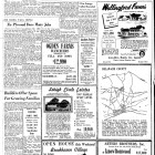
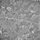
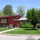
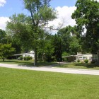
Hi Cheryl. I grew up on Paddock Road in Greystone Manor (Builder’s name: “Graystone Farms” and moved back here a little over a year ago. I have always been curious about what this spot looked like before the development was built. It’s always been my understanding that the 2 buildings of the Graystone Apartment were originally the barn and clubhouse for the horse farm that was here. Do you know of any photos that exist of this locations before the development was built? If not, do you have any suggestions for places I might check? Thanks for your attention. Lee