 ReGIS is 10!
In Spring 2005 we launched the public version of the Cultural Resources Geographic Information System (CRGIS) website. The database search was named AskReGIS and this little guy was born (thank you Kathy Alsvary!). Since then hundreds of people have consulted him every day to find out what he knows about historic places in Pennsylvania. He has had a few face lifts over the years, and will continue to have work done, as he struggles to keep up with the times, but he remains on duty, helping us share the information we collect about our past. He is a little shy these days. Have you seen him peeking through his window?
Although the basic functionality is unchanged, there have been several mapping and search options added over the years. Map options now include road maps, USGS topographic maps, and aerial photography. The newer Advanced Searches in AskReGIS make it possible to search almost any field in our extensive database.
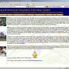
- The CRGIS landing page when the site debuted in 2005.
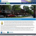
- The CRGIS landing page revamped and relaunched in 2015.
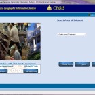
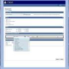
- The search page when CRGIS launched in 2005.
- The opening search page revamped and relaunched in 2015.
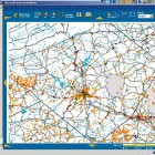
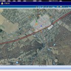
- The CRGIS map function when the site launched in 2005.
- The new CRGIS map feature new features aerial photos.
- The CRGIS Advanced Search page was revamped in 2015.
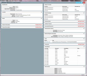
The latest rejuvenation is the details pages. These are the page you see when you “click” on a resource on the map or on the information button at the beginning of a row in the search results. There are different ones for each type of resource – survey reports, archaeological sites, and historic resources. The new ones have more data than before. In addition to several new fields in every report, we have added “Outbuildings” and “Observation” sections to the historic resources – details that were collected as part of the Agricultural Survey, but that were not visible in the old report.
The detail reports are now scalable for mobile devices, too, so you can view them on your phone or tablet. Any individual field is only shown if there is data for it, so there is less wasted space than in the old forms. Overall, we hope you will find them to be clearer and easier to use.
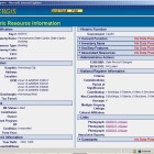
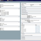
- The old version of the Details report for a historic resource .
- The 2015 look of the Details report for a historic resource in CRGIS.
How did we get here?
One of the jobs of each State Historic Preservation Office is to maintain an inventory of historic resources within their state. The Pennsylvania Historical and Museum Commission has a long history of recording resources – both above and below the ground. Originally it was all collected on paper and we continue to maintain those legacy files. But they are delicate, and only accessible in our office. So we tried entering all of the data into a database in the 1980s. But that was cumbersome, too, and not easy for a novice to use.
In the mid 1990s, PHMC entered into a partnership with PennDOT to make all of this information available through a Geographic Information System. We had data they needed and they had a way to display it. With assistance from the Baltimore District of the Army Corps of Engineers, CRGIS was developed as a way to share data among the three agencies to expedite project review. It was especially important to staff members in offices outside of Harrisburg who found it difficult and costly to travel to use the paper files. In the early 2000s it became an intranet web application and it was quickly determined that our interests could be better served if more people could access the information remotely. So GeoDecisions, the designer of the system, turned it into a public website, earning the company and the two agencies the Diamond Award for Engineering Excellence from the American Council of Engineering Companies of Pennsylvania (ACEC/PA) in 2005. The stated purpose of this annual award was “To recognize Pennsylvania engineering firms and their clients for the outstanding contributions which enhance the social and economic welfare of the Commonwealth of Pennsylvania.” We continue to be dedicated to this challenge and will continue to add to and change the CRGIS into the future. So stay tuned for more exciting changes.
Happy Birthday ReGIS!


Leave a Reply