It’s time for our six-month update to bring you the latest and greatest in new National Register of Historic Places listings!
Since the end of July 2020 through January 25, 2021, there have been eleven new listings, including an archaeological site, a couple churches, lots of factories, a farm, a goup of parks and a historic district. The following excerpts (slightly edited for space) and photographs from the National Register nominations give you a glimpse into these historic places.
Ohringer Building
LISTED, 8/6/2020
The Ohringer Home Furniture Store (“Ohringer Building”), located at 640 Braddock Avenue, in Braddock, Allegheny County, was constructed in 1941. The highest-rise building on Braddock Avenue, the 8-story building is distinguished by its curved northeast corner with glass block windows, a hallmark of the Moderne style.
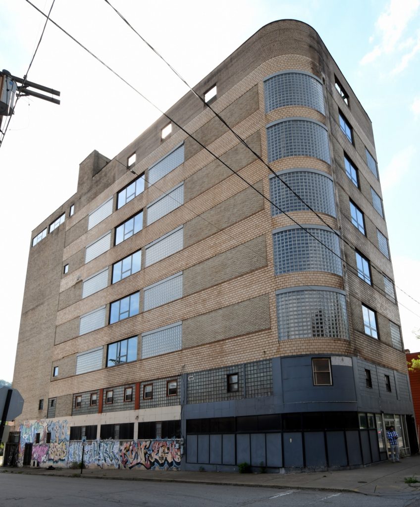
The building was developed as the headquarters for a locally significant furniture company that commissioned Pittsburgh-based architect Harry H. Lefkowitz to design the building in the Moderne style. The building was occupied by the Ohringer Home Furniture Company until 1964 and was later used as offices for Allegheny County until 2006. For several years the building was used as artists’ studios but was vacated in 2009.
The Ohringer Building is locally significant under Criterion A in the area of commerce for in its association with prominent Braddock and Pittsburgh region furniture retailer, Ohringer Home Furniture. The construction of the subject building enabled the expansion of Ohringer’s furniture business at a time when many family-owner retailers were closing their doors.
The Ohringer Building is also locally significant under Criterion C for Architecture as an example of Moderne style of architecture applied to a retail store in the small borough of Braddock, outside Pittsburgh. The period of significance begins with the building’s construction in 1941, as a cutting-edge store and showplace for Ohringer’s furniture company designed by prominent Pittsburgh-based architect Harry H. Lefkowitz and ends when the company went out of business in 1964.
Hazelwood Brewing Company
LISTED, 12/21/2020
The former Hazelwood Brewing Company (HBC) is located on the 5000 block of Lytle Street Pittsburgh, Allegheny County. Situated within the mixed-use, urban Hazelwood neighborhood within the City, the surviving buildings of the HBC is comprised of two buildings built in 1905: a brewery and an ice house.
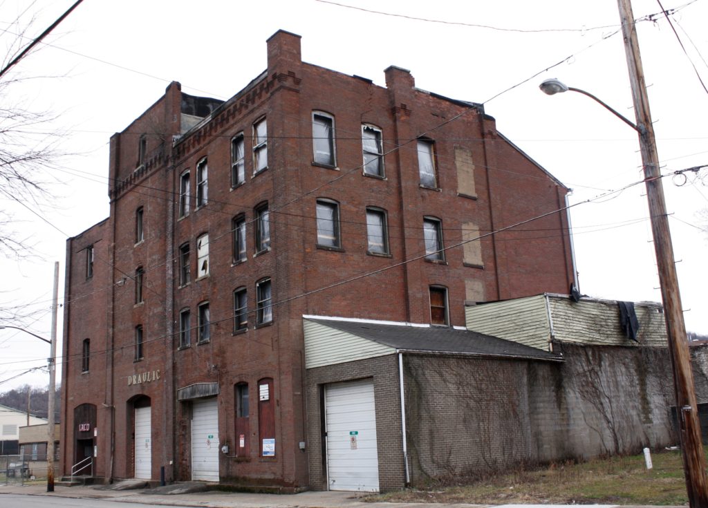
The Hazelwood Brewing Company (HBC) is significant under Criterion A in the Area of Industry for association with the development of the brewing industry in the City of Pittsburgh in the early 20th century. The HBC operated during a period of transition for the brewing industry, from brewing on an independent, hand-crafted, local scale to brewing on a fully mechanized, mass-produced, regional scale.
The HBC is also significant in the Area of Social History for its association with the early enforcement of Prohibition in the City of Pittsburgh. The brewery was the target of a series of sensational raids by federal agents and a corruption trial from 1922 to 1924, that attracted national attention. The “Pittsburgh brewery case” became the subject of Senate hearings on the Treasury Department’s enforcement of prohibition, which ultimately led to the establishment of a joint Congressional committee to investigate the impact of prohibition on the nation.
Hunter Saw & Machine Company
LISTED, 1/7/2021
The Hunter Saw & Machine Company complex is located at the corner of Butler and 57th streets in the Lawrenceville neighborhood of Pittsburgh. The complex consists of four attached masonry buildings constructed between 1907 and ca. 1945: Machine Shop A, Machine Shop B, a small, two-story red-brick office building; and a one-story storage and shipping wing.
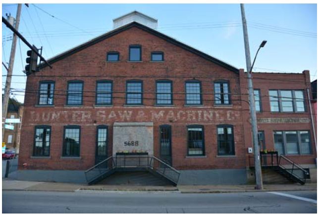
The Hunter Saw & Machine Company is eligible for the National Register under Criterion A in the area of Industry for its specialized contribution to the metals manufacturing industry which powered the economy of Lawrenceville, and all of Pittsburgh, from the post-Civil War years
through the middle of the 20th century.
Hunter Saw & Machine Company produced specialized metal circular saws which made the finished products of the steel mills possible. Under the entrepreneurial leadership of company founder Henry S. Hunter and his successors, the company also manufactured and patented other tools, such as a saw tooth grinder, which contributed to the innovation and competitiveness of the steel industry in Lawrenceville and Pittsburgh. Hunter Saw employed skilled workers even as the larger steel mills were increasingly mechanized, and it adapted to the decline of the steel industry after World War II by diversifying into other products.
Ambridge Commercial Historic District
LISTED, 8/13/2020
The Ambridge Commercial Historic District encompasses most of the buildings on Merchant Street between 3rd and 8th Streets in Ambridge Borough, Beaver County. The district contains 139 resources, of which 112 are contributing buildings, 17 are non-contributing buildings, and 10 are non-contributing vacant lots (sites) once occupied by demolished buildings.
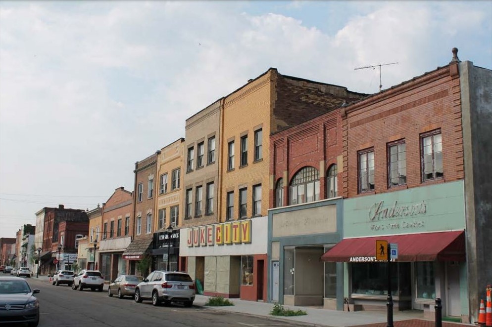
The Ambridge Commercial Historic District is locally significant under Criterion A for Commerce and per Criterion C for Architecture. This was the commercial hub for the Borough of Ambridge, a significant and prosperous Ohio River Valley industrial community for much of the twentieth century. The scope, scale, and diversity of goods and services offered within the Ambridge Commercial Historic District made it a commercial hub not only for the citizens of Ambridge but also for the citizens of surrounding communities in the region.
The period of significance for the Ambridge Commercial Historic District begins in 1903, with the platting of Ambridge by the American Bridge Company, and ends in 1956, when suburbanization hastened the demise of the Ambridge Commercial District and similar commercial districts in the Ohio and Beaver river valleys.
Orton, Almerion C. & Barbara Moseman, Farm
LISTED, 10/8/2020
The Almerion C. & Barbara Moseman Orton Farm is located in Venango Township, Erie County, PA. It was continuously owned and operated for 145 years by three generations of the Orton family. Total resource count is eight contributing resources: three buildings, c1850 wood frame house with attached summer kitchen, c1890 carriage house, 1901 Pennsylvania barn with attached c1930 milk house; one structure, 1934 octagon silo; and four objects, c1960 natural gas well storage tanks/pumps. Important historic landscape features include tree lined farm boundaries, drainage channel with bridge, remnant orchard trees, and gas well storage facilities.
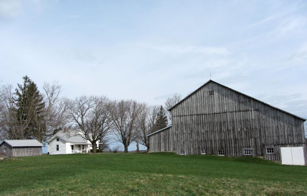
The Almerion C. & Barbara Moseman Orton Farm, Venango Township, Erie
County, is being nominated under Criteria A, in the area of Agriculture. The farm reflects the history and trends discussed in the Northwestern Woodland, Grassland, and Specialized Farming, c1830-1960 regional context of the Agricultural Resources of Pennsylvania, c1700-1960 Multiple Property Documentation Form (MPDF). Production numbers, farm buildings, landscape features, and agricultural land collectively reflect historic regional trends, and convey the farm’s National Register significance.
Parkside Chapel
LISTED, 10/7/2020
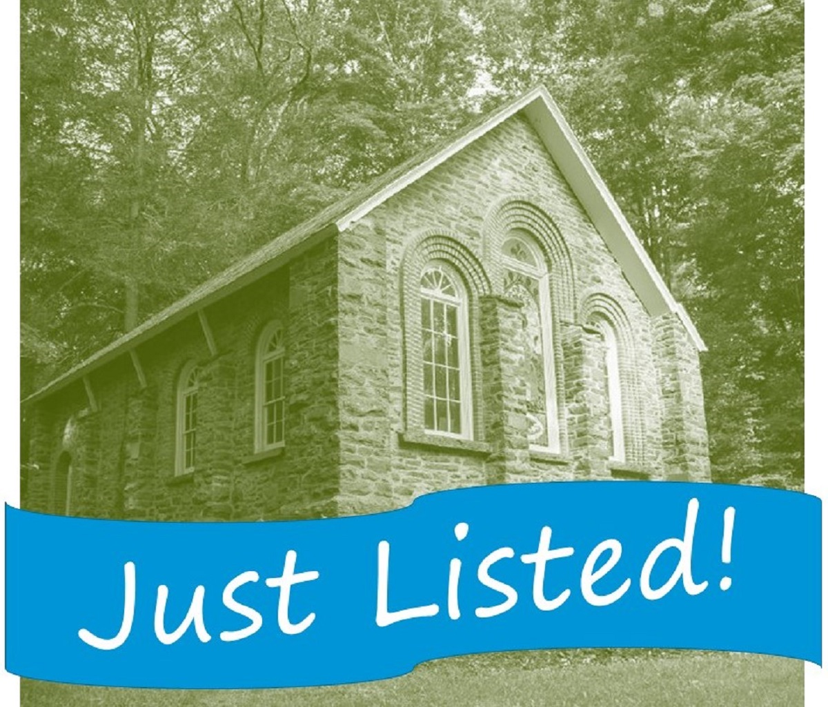
The Parkside Chapel of Henryville is located in Henryville, a small village located in Paradise Township in Monroe County. The Parkside Chapel of Henryville was built in 1893. The building was constructed as a Victorian chapel with Romanesque influences, standing 32 feet high and 28 feet wide, with a depth of 45 feet.
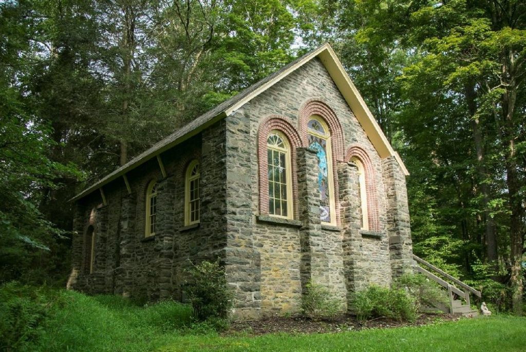
The Parkside Chapel is locally significant under Criteria C for Architecture as a unique rural Victorian era vernacular chapel with Romanesque influenced details and features. The Chapel, though small in scale, has a substantial presence on the site as a result of the Romanesque style’s
influence. This includes the primary use of stone and brick masonry, tall, arched windows, and flat stone buttresses on the exterior. The interior space features decorative wood paneling, carved trusses, and apse with raised alter floor. It was originally commissioned as a nondenominational chapel to serve vacationers and seasonal residents in the Poconos and stands as a reminder of the popularity of the region as a popular vacation destination for generally well to do vacationers. While most of the popular vacation spots in the Poconos have deteriorated, the Parkside Chapel remains in excellent condition.
The Parkside Chapel meets the requirements for listing under Criteria Consideration A as a religious property, as its primary significance stems from its architectural distinction.
R. K. Laros Silk Mill
LISTED, 11/24/2020
The R.K. Laros Silk Mill is located along the 600 block of East Broad Street, in Bethlehem, Northampton County. It is a large complex of six interconnected units, including buildings, a boiler house and chimney stack, constructed between 1922 and 1968.
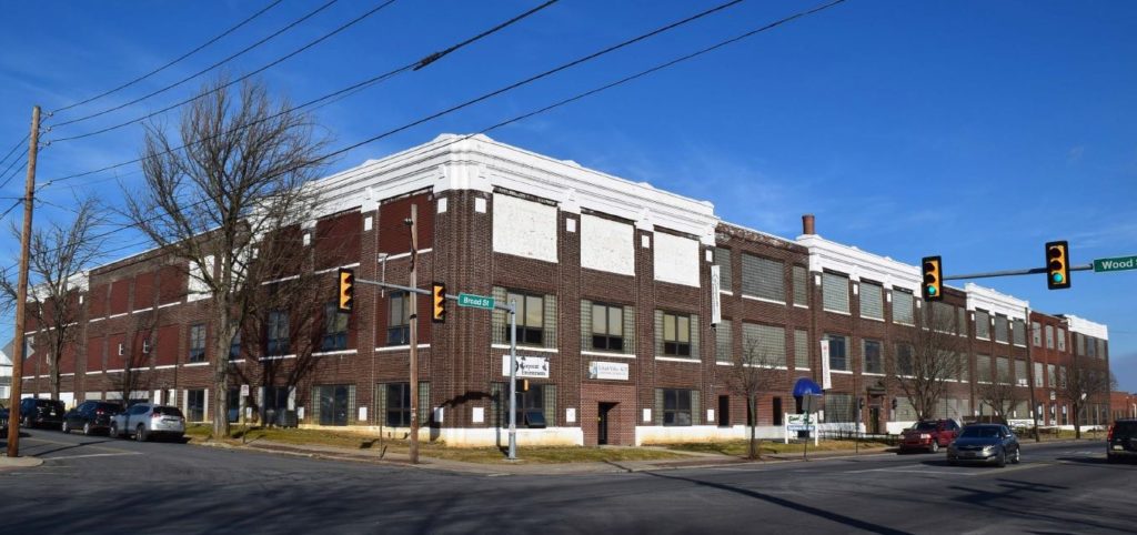
The R.K. Laros Silk Company mill is significant under Criterion A in the area of Industry as one of the Lehigh Valley’s largest and longest operating fabric and fabric-goods mills, producing materials through two periods of significance- under the R.K. Laros Silk Company from 1922-1956, and as the Sure Fit Products Company from 1956-1995.
Founded by Russell Keller Laros in 1919, the R.K. Laros Silk Company first constructed a mill in the Miller Heights neighborhood of Bethlehem Township. With quick success came the need for a larger mill; in 1922, the company awarded William Steele and Sons Company of Philadelphia to design the mill at East Broad Street in the city of Bethlehem. The company grew continuously through the Great Depression, and transitioned from being contract silk throwers to fabric and garment producers. In 1938, the company patented the Dimensional Slip, which claimed to fit nine
different body types and sold upwards of eight million units throughout the United States. Eventually Sure Fit Products outgrew the site, and vacated it in 1995.
Edward Corner Marine Merchandise Warehouse
LISTED, 10/6/2020
The Edward Corner Marine Merchandise Warehouse stands at 1100-1102 N. Delaware Avenue in the Fishtown neighborhood of Philadelphia, at the northeast corner of Delaware Avenue and Shackamaxon Street. The 3-story, rectangular brick building was constructed in 1921 by A. Raymond Roff.
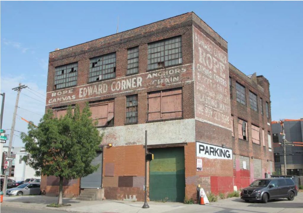
The Edward Corner Marine Merchandise Warehouse is significant under Criterion A, Industry, as a prominent purveyor and warehouse of marine-related items, which was geographically advantaged by its proximity to the Port of Philadelphia, the Delaware River and numerous local shipyards. While located at 1100-1102 N. Delaware Avenue, the Edward Corner Marine Merchandise Warehouse served as a support trade, offering such specialties as rope, canvas, anchors, chains, boat supplies, blocks, falls and blasting mats.
The commercial warehouse is reflective of the city at the time of its construction in both that the physical fabrics of the building and the operations within it were a direct result of the port and its implications and establishing a family business that remained as one of the most consistent operators in the city, lasting nearly forty years in the same location. Even though the original tenants are long-gone, the building remains, outlasting nearly all of its contemporaries and attests to the strength of Philadelphia’s once-thriving, maritime-related, industrial corridor.
St. Gabriel’s Roman Catholic Church Complex
LISTED, 1/14/2021
St. Gabriel’s Roman Catholic Church Complex is located along the 2900 block of Dickinson Street in the Grays Ferry neighborhood of South Philadelphia. The approximately 2.6 acre site, which contains six contributing resources on three parcels, was built in stages between 1897 and 1948. With the exception of the Parish House, which is Art Deco in style and faced in limestone, the buildings feature a consistent Romanesque Revival treatment in quarry faced Port Deposit granite.
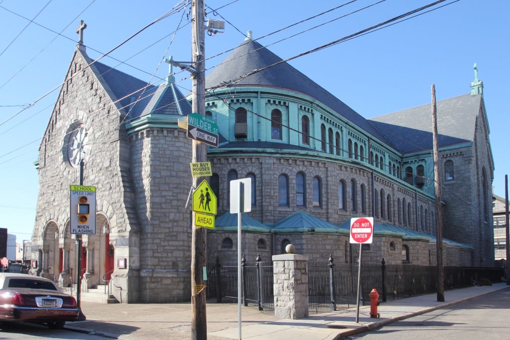
St. Gabriel’s Roman Catholic Church Complex is significant under Criterion A in the areas of Social History and Ethnic Heritage as the religious and social anchor of the Irish-American community of Grays Ferry in South Philadelphia. Built by and for predominantly Irish immigrants and their families beginning in the late 1890s, St. Gabriel’s is highly characteristic of the largely self-sufficient “national” or ethnic Roman Catholic parishes that were built throughout Philadelphia for new arrivals from Ireland, Italy and Eastern Europe from the 1840s onward. Like many such parishes, St. Gabriel’s fulfilled a need not only for spiritual fulfillment and guidance, but was also an instrument of social support, education, healthcare and economic assistance to a geographically dislocated population thrust from the rural confines of Ireland into the often bewildering American urban environment.
St. Gabriel’s is also significant under Criterion C in the area of Architecture as a remarkably intact complex of parish church buildings primarily in the Romanesque Revival style by one of the most well-known Catholic church architects in Philadelphia during the late nineteenth and early twentieth century, particularly Edwin F. Durang and his son, F. Ferdinand Durang.
The St. Gabriel’s complex meets Criteria Consideration A as a religious institution that is nominated for architectural merit and its important local role in the Irish-American community.
Mothers’ Memorial, Hoffman Memorial, and Veterans’ Memorial
LISTED, 9/17/2020
The 1938 Mothers’ Memorial, the Hoffman Memorial, and the Veterans’ Memorial are three small, landscaped memorial parks connected by the associated Hoffman Boulevard (S 61) and a stretch of Market Street in the borough of Ashland, near the northern edge of Schuylkill County.
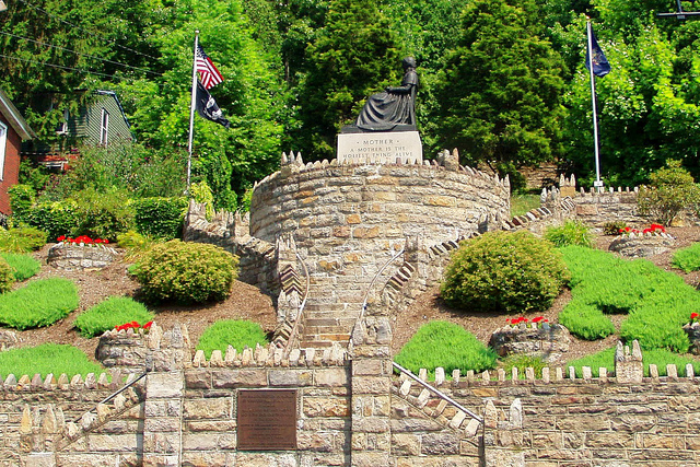
The Mothers’ Memorial, Hoffman Memorial, Veterans’ Memorial, and Hoffman Boulevard are locally significant under Criterion A in the areas of Social History and Government/Landscape Architecture as important examples of WPA era construction, and the motivation behind their creation. The Ashland Boys’ Association (ABA) envisioned the Mothers’ Memorial, the associated Hoffman Boulevard street islands, and the Hoffman Memorial. They worked with the Borough of Ashland to get them constructed using a combination of private and Borough funds with federal Works Progress Administration labor. The Veterans’ Memorial followed as part of the same undertaking.
The ABA formed in 1901 in response to the widespread job loss and dispersion of coal miners and workers as coal mines closed and the industry and local economy changed. It was a homecoming organization that welcomed former Ashland residents who had left seeking employment elsewhere back to their hometown. Their motto was “Come on Home” and they instituted annual reunions held on Labor Day. The focus of the 1938 Mothers’ Memorial is a bronze statue inspired by James Whistler’s painting, Arrangement in Grey and Black, No. 1: Portrait of the Artist’s Mother (also known as Whistler’s Mother). New York City-based artists Emil Siebern designed the Mothers’ Memorial statue and Julius Loester sculpted it.
Ashland Borough Manager Harold Burmeister designed the Memorial’s site as well as the Veterans’ Memorial. In their use of local stone and integration into the natural landscape, they, along with the Hoffman Memorial, are typical of the WPA era projects. In addition to the story of the ABA’s creation of the Mothers’ Memorial, this district of four sites presents an important local example of the work of the WPA in creating parks, memorials, and civic sites that provided amenities for the local community. The Mothers’ Memorial especially holds significance for its role in memorializing home and a nostalgia for the past.
Fort Dewart
LISTED, 1/7/2021
Fort Dewart, which straddles the Bedford-Somerset County line in southern Pennsylvania, was a British military redoubt built in August, 1758. The small fortification was part of a chain of defensive forts and supply stops built by General John Forbes’ troops during the second British campaign to repel the French from Fort Duquesne (present day Pittsburgh) during the French and Indian War.
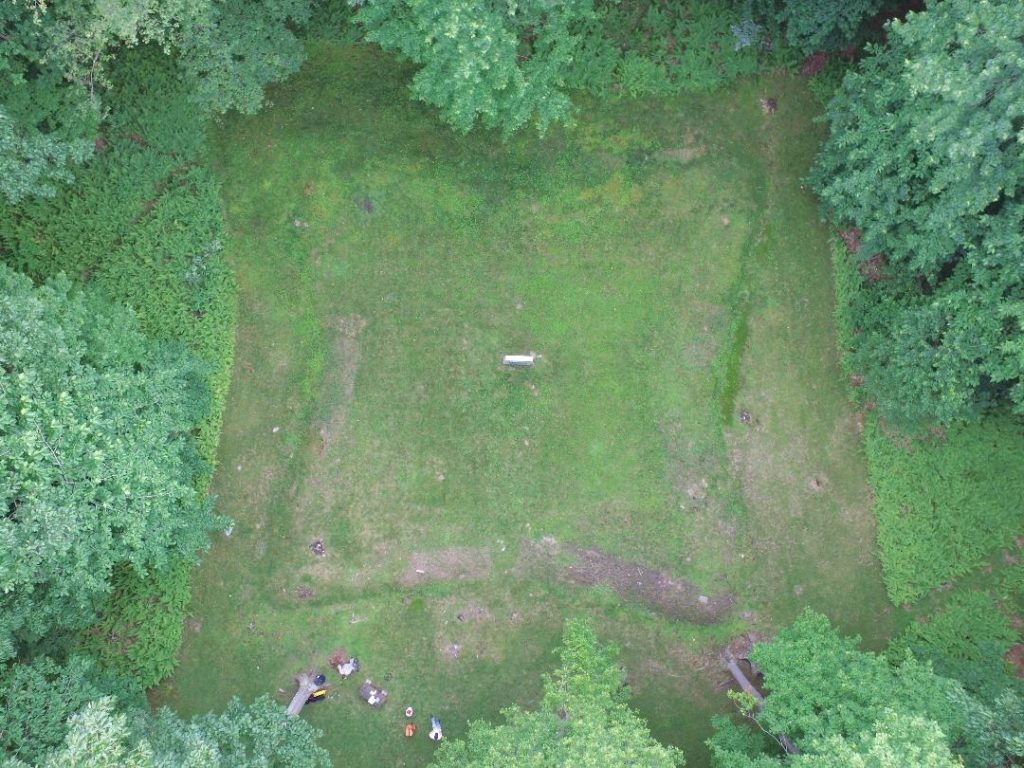
The site of Fort Dewart holds the earth and stone breastworks and other evidence of a 60ft x 60ft French and Indian War redoubt, built along the Forbes Road in 1758 to serve as a protected British depot on the line of communications and supplies between Fort Bedford and the British military’s ultimate goal, the French army’s Fort Duquesne (in what is now Pittsburgh). Fort Dewart is likely the most-intact remains of a fortification from Brig. Gen. John Forbes’ expedition to capture Fort Duquesne, and was used by the British until 1763.
Fort Dewart and the immediately adjacent portion of Forbes Road are significant under Criteria A and D for the strength of their association with the military campaign that successfully claimed Fort Duquesne, and ultimately expanded the British Empire westward to the Mississippi River, and as the most-intact example of a redoubt from the Forbes expedition, able to provide important information regarding the construction and use of such forts, and as an intact portion of Forbes Road, which has otherwise been extensively altered. Fort Dewart’s four-sided, star-shaped design was the standard strategic plan used during the time of the French and Indian War. The fort served as a small respite after climbing up the steep Rhor’s Gap section of Forbes Road, and the site has a singular temporal association offering a clear lens of this particular experience of the French and Indian War in Pennsylvania.
Comment Policy
PHMC welcomes and encourages topic-related comments on this blog. PHMC reserves the right to remove comments that in PHMC’s discretion do not follow participation guidelines.
Commenters and Comments shall be related to the blog post topic and respectful of others who use this site.
Commenters and Comments shall not: use language that is offensive, inflammatory or provocative (this includes, but is not limited to, using profanity, obscene, or vulgar comments); disparage other commenters or people; condone illegal activity; identify the location of known or suspected archeological sites; post personal information in comments such as addresses, phone numbers, e-mail addresses or other contact details, which may relate to you or other individuals; impersonate or falsely claim to represent a person or an organization; make any commercial endorsement or promotion of any product, service or publication.
If you would like to comment on other topics not related to this blog post but related to PHMC, please fill out the PHMC Contact Us Form.
Leave a Reply