The intersection of technology and historic preservation is nothing new as the field has embraced new and different ways to engage with people, diagnose issues in buildings, and find long-buried archaeological sites. This week’s post by Christine Musser of the West Short Historical Society and Harrisburg University tells the story of how drones were used to document a historic property.
Partnerships for Preservation
As a director of the West Shore Historical Society‘s (WSHS) Board, I reached out to Don Paul Shearer, Board President, about partnering with Harrisburg University (HU) for a historic preservation project involving the use of drones and Geographic Information Systems (GIS).
Once approved by the Board, HU Professor Albert Sarvis and I prepared a project plan. The project’s ultimate goal is for school students in Cumberland County from third through twelfth grade to learn the County’s history and the importance of historic preservation. The finished project will provide students with an online interactive “storymap” containing narrative and imagery of the property’s history as well as the locations of other historic properties and structures throughout the region.
About McCormick Farm
The historic property chosen for the pilot project was McCormick Farm (PA-SHARE Resource #1988RE00677). The Farm is the original homestead of the McCormick family, one of America’s most prominent families. Thomas McCormick settled the property in 1745. Beneath the house’s stucco exterior is the original log structure built-in 1748. The farmhouse was expanded to its current size and appearance by the early 20th century.
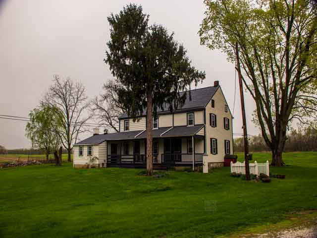
From the late 19th century to 1917, the McCormick Estate Farm Club often met there to learn better ways to raise livestock and crops. In the early 1930s, Vance McCormick’s friend, Harriet Gilbert McPherson, the Harrisburg area’s first female architect, “restored” the farmhouse to the Colonel Revival design and added a Colonial Revival Gate and Pump.

McPherson received her master’s from Cambridge School of Domestic and Landscape Design at Smith College. Her focus comprised mainly on the Colonel Revival style.
The McCormick family owned the property until the mid-1980s when it was donated to the Natural Lands Trust. In March 2018, SHPO determined the house and property eligible for the National Register of Historic Places under Criteria C for Architecture.
Documentation with Drones
Visual documentation of historic properties, like the McCormick Farm, is a common practice aimed at capturing and archiving evidence of condition at distinct points in time. Photographing unique angles or details of historic structures is often not possible given the limitation of handheld cameras.
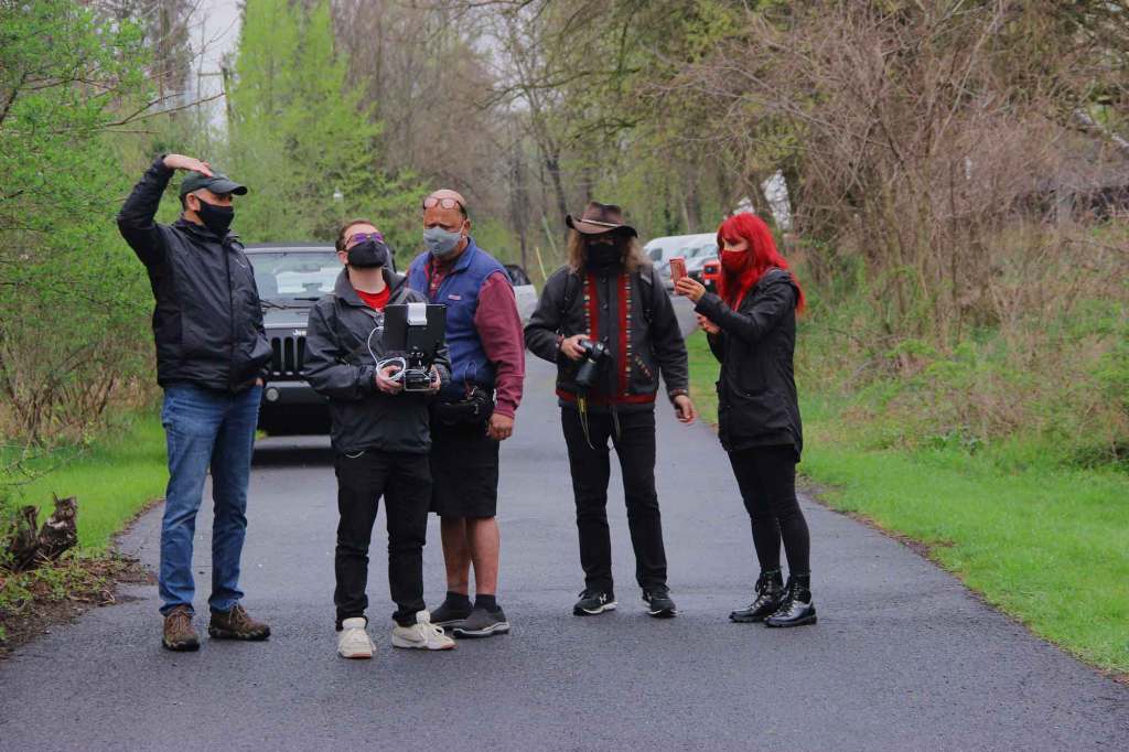
The advent of drone technology, and the high-resolution cameras they carry, has broad reaching application, including the photographic capabilities of historians. Harrisburg University has been using drones for photography, mapping and multispectral imaging for the last 5 years.
We surveyed the McCormick property in April 2021.
For the McCormick farm, two distinct drone photography techniques were employed: manual and automated. Manual flights were conducted to position a Matrice 210 drone between 10 and 100 feet in the air to capture oblique photos like figure below.
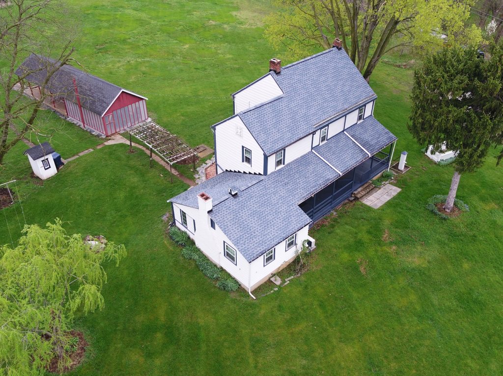
Also, 4k resolution video recordings were collected to provide additional context and sense of place. These unique views augment the visual archive and provide a more comprehensive record of the property and structures.
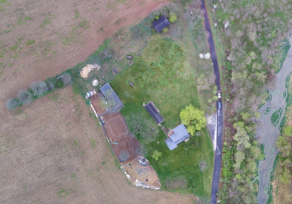
The second drone imaging method was conducting pre-planned flights to capture numerous nadir (top-down) images of the property. The flight plan shown in figure 2 was created using Pix4D Capture software and represents a double grid flight where the drone flies along a preplanned route to capture images with specific overlap between them.
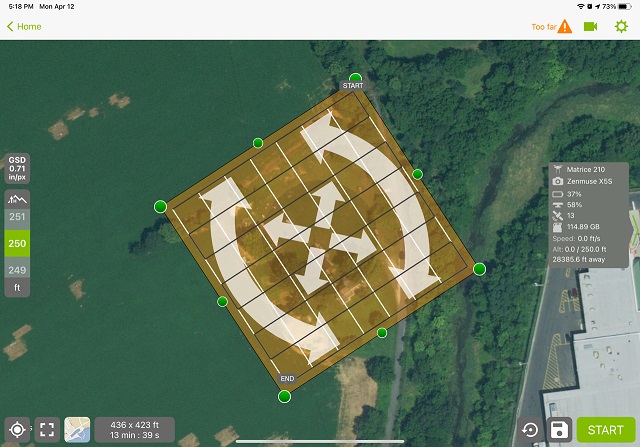
Guided by GPS the Matrice 210 drone flew at 250 feet in this programmed pattern capturing images along the white and black paths. Photo stitching software, Pix4D was used to merge all the photos into a single Orthophoto mosaic. The resulting image shown in figure 3 captured the entire property and structures at approximately ¾ inches per pixel resolution and with a relative location accuracy, meaning accuracy of measurements made on the image, of under 3 inches.
Check out the YouTube video of HU’s drone flights over McCormick Farm.
Next Steps
A student in Harrisburg University’s Geospatial Technology program worked with faculty to obtain these drone image products and will subsequently use them within Geographic Information Systems. Numerous historic properties and structures in the West Shore Historical Society’s region and their detailed historical information will be added as point locations within GIS along with the detailed base map imagery such as figure 3 for the McCormick farm property.
Once mapped, an interactive online “Storymap” will be produced allowing students and the public to explore these historic properties, their historic attributes and high-resolution drone photos. It is hoped that this data and visually rich and interactive tool will inspire an enhanced interest in our local history.
The West Shore Historical Society conceptualized the end product to improve engagement through new and unique visual tools. Also, to improve information sharing through the interactive dynamic map where the viewer can move around. Viewers do not have to flip through clusters of photos or PDF documents, which is a timesaver. Students and the public will learn the importance of local history, historic preservation and that the chosen properties have a local historic designation with the possibility of visiting the protected landmarks.
Christine Musser is an author, historian, and advocate for heritage preservation. In December 2020, she earned a master’s in Applied History with a concentration on Historic Preservation & Cultural Resource Management from Shippensburg University.
ALBERT SARVIS, PMP, GISP is Assistant Professor of Geospatial Technology & Director HU Geospatial Technology Center. He received his B.A. in Geoenvironmental Studies from Shippensburg University in 1991 and M.A. in Geography at Ohio University in 1994. In 2005 he began working with Harrisburg University as a corporate faculty member helping to develop and teach the Geospatial Technology program before joining the HU staff full time in January 2011.
Leave a Reply