Earlier this year, the PA State Historic Preservation Office started working on new upgrades and improvements to PA-SHARE. We’re calling this effort PA-SHARE 2.0.
PA-SHARE launched in February 2021 and Surveyor launched later that year in August. This custom-built system replaced CRGIS and many of the legacy databases used to track resources and projects. Since launch, PA SHPO staff have tracked external and internal user feedback for PA-SHARE and Surveyor. This feedback provided the basis for much of the 2.0 scope of work.
What to Expect
In a broad sense, this second phase of PA-SHARE will include upgrades, updates, and enhanced features such as:
- Improvements to Surveyor,
- Database improvements,
- Changes to how data is displayed for clarity and consistency,
- Improved search capabilities,
- Better and more accessible online help,
- Compatibility with the latest version of ESRI GIS software,
- And many more!
PA-SHARE 2.0 will be updated through a series of major and minor releases over the next 18 to 24 months. We’ll let you know about what has changed for external users throughout the 2.0 process in a few ways:
- In a blog post like this one. If you’re not a regular blog visitor, type “PA-SHARE” in the Search box. You’ll get a list of all posts related to PA-SHARE.
- In our newsletter. PA SHPO sends out a monthly newsletter, Keystone Preservation Post, that includes the previous month’s posts and other important news. You can sign up for the newsletter from the blog homepage.
- In the PA-SHARE Bulletin Board. There is dedicated space on your internal PA-SHARE home page in the upper right corner for news, tips, and alerts.
You may find that you sign in to PA-SHARE one day and it looks or functions differently. If you have questions or need some help, please contact the PA-SHARE Help Desk at pashare@pa.gov.
Recent Updates for External Users
You may have already noticed that a few things look pretty different.
Color Coding
A resource’s National Register status is more clearly indicated with a color-coded header at the top of each record. These colors are also used on PA-SHARE maps to visually illustrate a resource’s status. If you forgot what each color stands for, you can also see the status in the upper right corner next to the resource number.
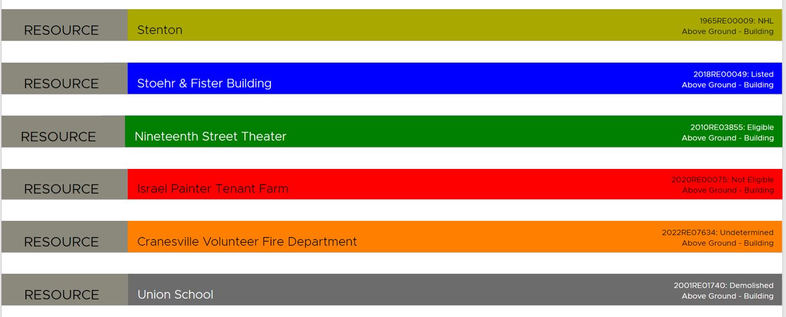
Colorful banners now give users information about a resource’s National Register status at a glance. From top: light green = National Historic Landmarks (NHL); blue = listed in the National Register; green = eligible for listing in the National Register; red = not eligible for listing in the National Register; orange = undetermined/not yet evaluated for listing in the National Register; and gray = demolished.
Above Ground Resource Records
The above-ground resource screen has been redesigned. For resources that have photos, you’ll now see a photo at the top of the page next to the map. Additional photos are located in a Photos grid at the bottom of the screen.
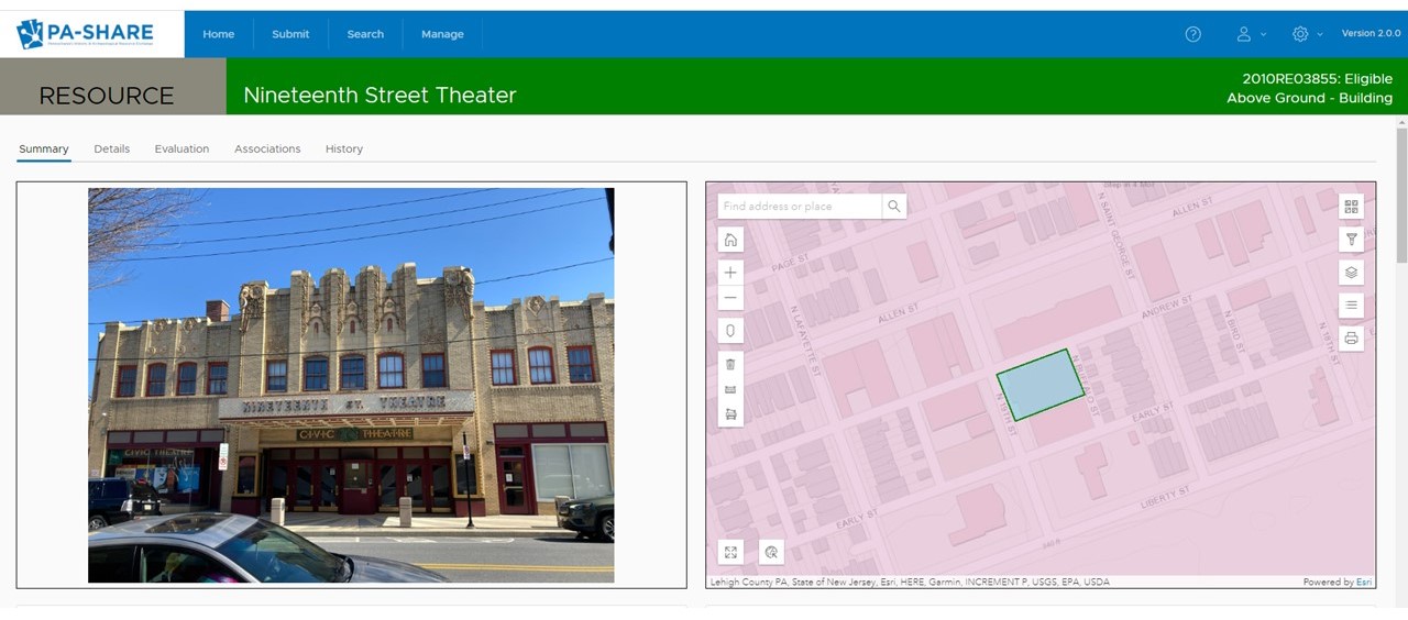
You’ll notice when you open an above-ground resource record now that a photo – if one is available – of the resource is next to the map.
Fields have been added in the Resource Overview section to indicate if the resource is related to a Multiple Property Documentation Form (MPDF) or a Traditional Cultural Property (TCP). A section for “Quick Facts” has been added for dates, styles, materials, and functions.
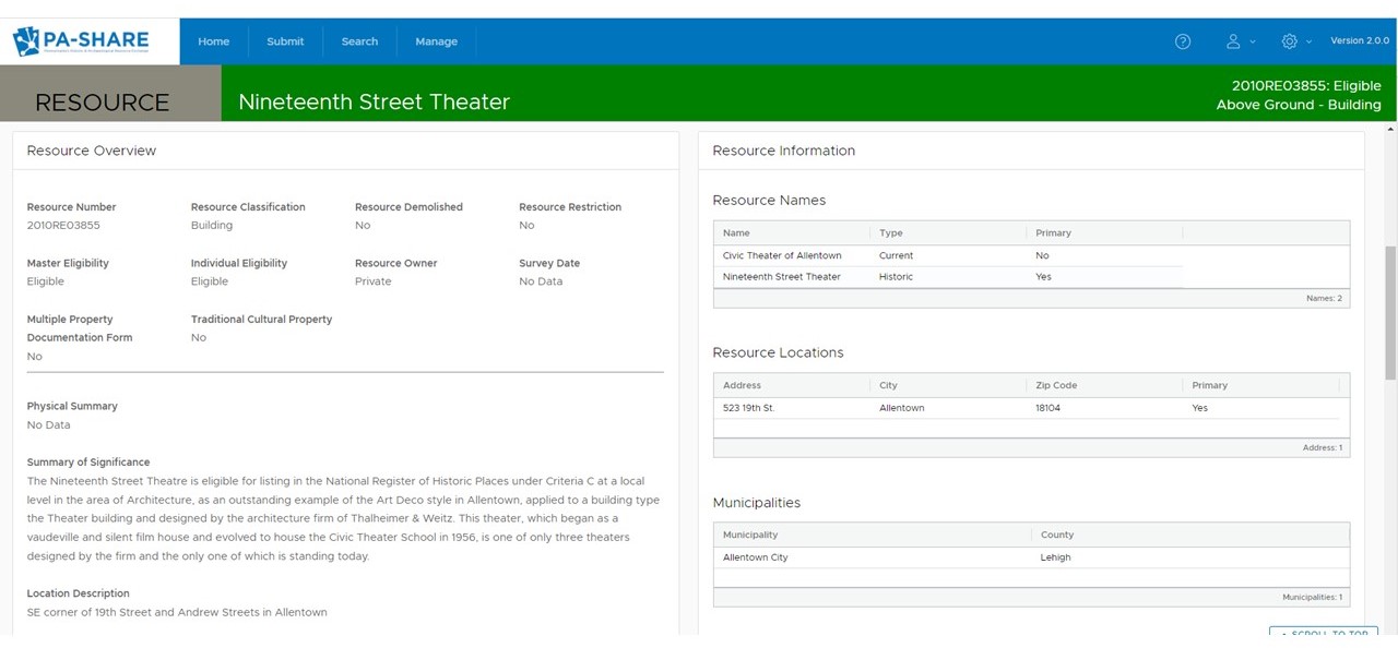
On the newly redesigned above-ground resource records, information has been rearranged and condensed to help reduce lots of scrolling.

The Quick Facts grid provides additional information at a glace on the summary page.
Please note that the export view, which is available to Pro and Business users, hasn’t been updated yet to reflect the new arrangement.
If you are a Pro or Business user, you will also have access to a new “Associations” tab in the resource record. Here you can see – and get to – any projects, reports, surveys, and other resources that are associated with the resource you’re viewing.
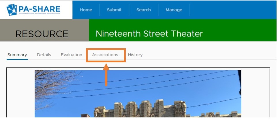
For subscribers, the new Associations tab is accessed through the row of tabs at the top left corner of the screen.
Project Submissions
A tab for submissions has been added to every project record. If you are a project contact, you can see a history of all submissions and directly respond to any open requests from the SHPO for more information.
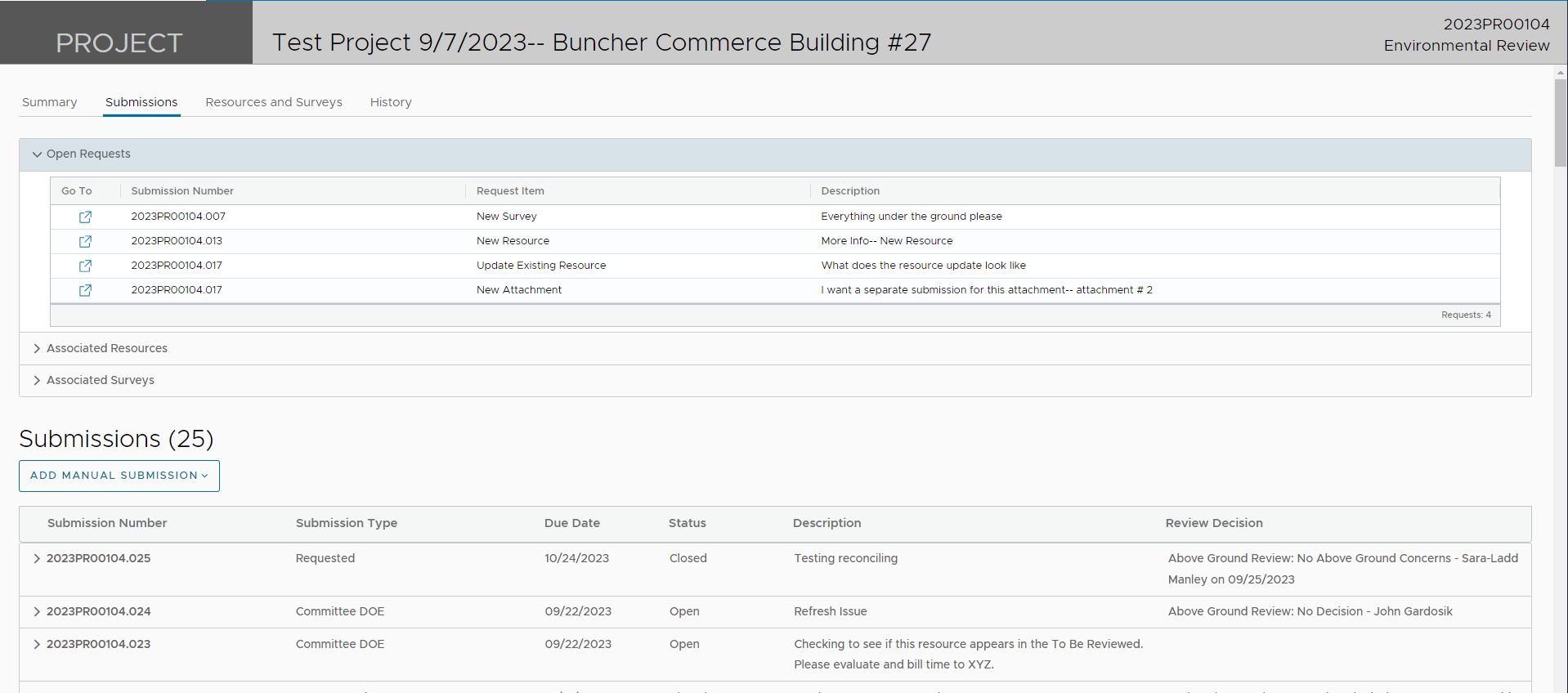
Project contacts can find open requests, associated resources, associated surveys, and all project submissions on the new Submissions tab in the project record.
Having trouble?
If you notice that PA-SHARE isn’t working quite right for you anymore after an update, please let us know.
Email the PA-SHARE Help Desk at pashare@pa.gov and tell us the resource, project, report, or survey number you’re looking at, what you’re trying to do, and what isn’t working. Screen shots are always helpful!

Leave a Reply