PA-SHARE is an innovative platform designed to streamline project submissions. PA-SHPO’s staff, key stakeholders and digital experts came together to design an online system to unite data sources, streamline systems, reduce unnecessary searching, and speed reviews.
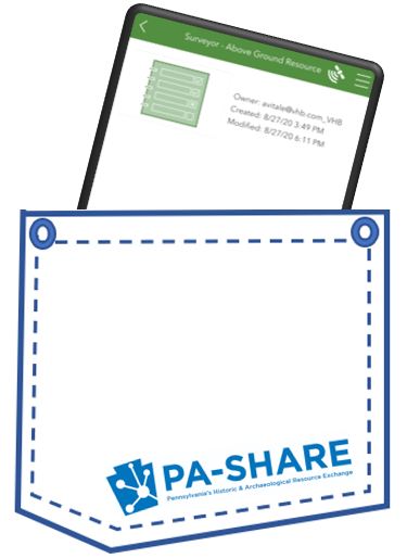
One of the great results? Surveyor, a mobile tool that is like having PA-SHARE in your pocket.
Another great result? Increased efficiency for all of us, which is one of the 4 great reasons to make PA-SHARE part of your plan.
ICYMI…
Before we explain how PA-SHARE will help save you time, here is a quick refresher…

PA-SHARE is an integrated on-line database management system and spatially enabled application with GIS technology that will be the primary interface for all program areas within the PA SHPO.
We are in the final stages of building PA-SHARE, which integrates tools used for doing business with the PA SHPO into one convenient place. Please review the post Countdown to PA-SHARE to see key dates leading up to deployment.

Efficiency Reason #1: PA-SHARE is a single source for data
PA-SHARE integrates cultural resources data that exists in both hard copy and digital formats and will support a revised business process for the SHPO. This will allow SHPO staff to more effectively manage the many programs for which we are responsible. Environmental Review, Survey, National Register, tax credits, grants, Historical Markers will all be tracked through this system.
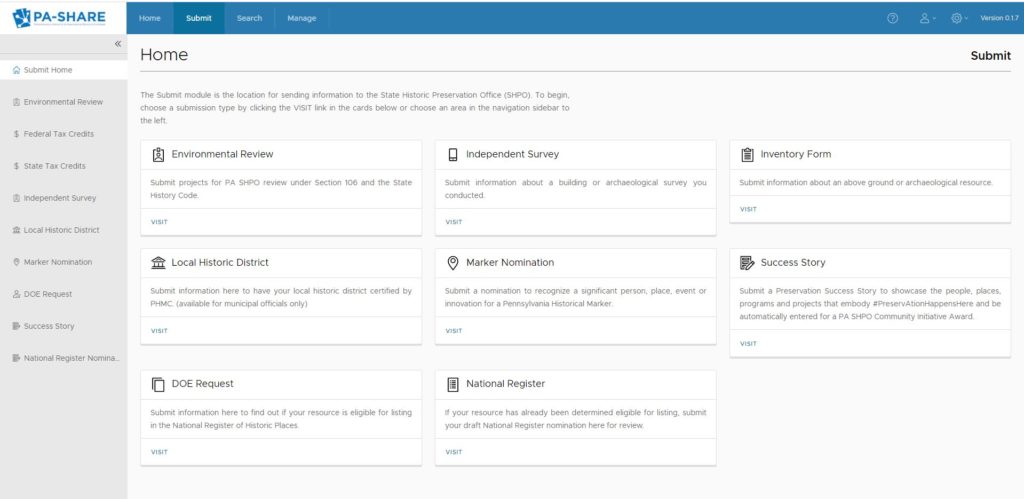
Since PA-SHARE combines all of PA SHPO’s databases needed for your project you can to get all your info from a single source, rather than making individual calls to each division of PA SHPO.
Efficiency Reason #2: PA-SHARE takes everything from paper to digital
The PA-SHARE platform eliminates the need for paper submissions and responses. Gone are the days of waiting on mail delivery, interdepartmental communications, and internal processing.

With PA-SHARE, you can submit projects, see responses in real time, and upload necessary information.
Efficiency Reason #3: Surveyor is PA-SHARE in your pocket
PA-SHARE’s companion app, Surveyor, is a form-centric, mobile tool for conducting resource surveys in the field from a variety of hand-held devices such as tablets and smartphones. It uses ESRI’s Survey123 to collect information about above ground resources, archaeological sites, and proposed districts.
Surveyor is integrated with PA-SHARE, which means that your mobile data collection is always tied to a particular project and the resource data is smoothly imported into the main inventory.
There are several tools within Surveyor that are available to users:
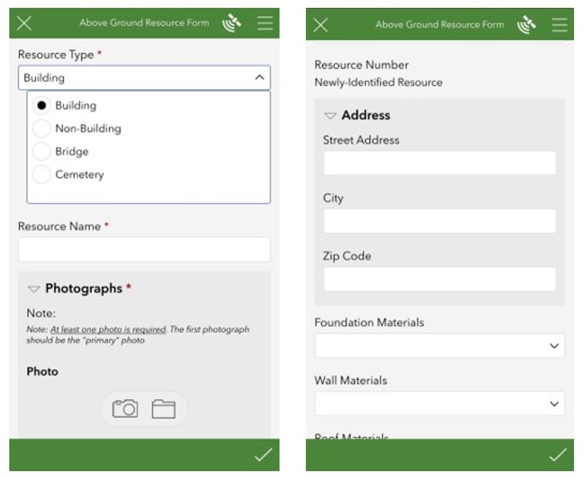
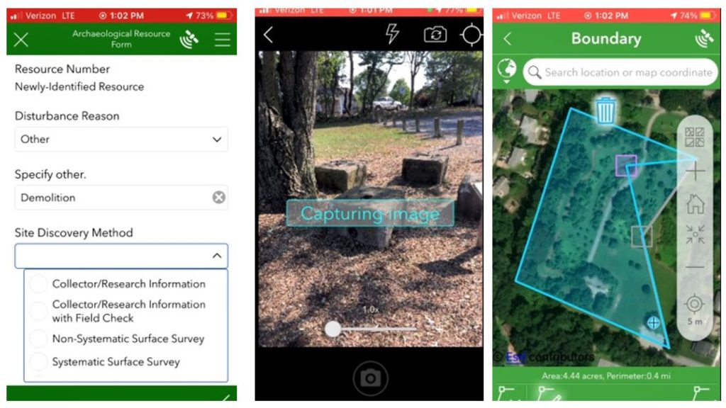
Field forms: Surveyor forms are designed for ease of use in the field, so they do not include all the data fields that are present in the PA-SHARE resource screens. It does allow users to propose new district boundaries, and captures boundaries, photos, and notes for all resources.
Surveyor can collect the minimum record for above ground resources such as buildings, bridges, and cemeteries.
The archaeological resource form focuses on information that is most important to capture in the field: physical setting & condition; field work details; and artifacts and features.
Surveyor Mobile: Surveyor’s mobile application, Surveyor Mobile, allows users to view existing above ground resources in the field. Users click on a resource in Surveyor Mobile which launches a new Survey123 form that is populated with the existing data from PA-SHARE, allowing for easy updates.
Surveyor Manager: This is a project management dashboard that gives the person leading the survey project flexibility and control while conducting their survey, prior to submitting to PA SHPO. It allows project leads to manage survey teams, edit data, conduct QA/QC, and return records to field technicians for revision.
How Will Surveyor Work?
Anyone within Pennsylvania can conduct surveys in the field from a variety of hand-held devices (e.g., smartphones, tablets, etc.), with all survey data being stored/managed in the “cloud.”
Access to Surveyor is offered through PA-SHARE’s Professional and Business subscription levels.
The process is basically this:
1. Survey project is created in PA-SHARE.
All surveys will first be submitted, approved, and created within the system as a “project” before Surveyor can be used to collect and submit resource data. In other words, the Surveyor tool is used within the context of a project.
After a project is initiated in PA-SHARE, users will submit a Survey Proposal, including the survey area boundaries and proposed methodology. This helps ensure that your mobile Survey is always associated with that project in PA-SHARE.
2. Surveyor is activated and survey starts.
Once a Survey Proposal is approved in PA-SHARE, the system will generate an associated project in ArcGIS Online. This will include the three different types of survey forms and the project management dashboard, Surveyor Manager.
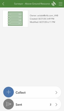
A project consultant or agency staff can then conduct and manage the survey using the various tools that make up Surveyor: collect data, manage the survey team, data quality control, and submitting data to the PA SHPO.
Even after initial data collection, additional information can be added to the resource through the Surveyor Manager dashboard, or even in PA-SHARE once a resource has been accepted by PA SHPO staff.
3. PA SHPO reviews and accepts survey data.
PA SHPO staff have their own web-based application called Surveyor Reviewer, with robust functionality for the review of submitted survey data, interacting with consultants/agency staff, linking incoming inventory forms to existing resources or proposed districts, and importing the submitted surveys to PA-SHARE.
Once resources are submitted in Surveyor, PA SHPO staff will review them in Surveyor Reviewer. SHPO staff can return it to the project lead through the Surveyor Manager dashboard for revision or accept the data for it to be imported into PA-SHARE.
Once all the resources have been submitted and accepted by the PA SHPO, the final report will be submitted in PA-SHARE and the rest of the review will proceed within the system.
We know you’ll have lots of questions!
We need to know what you need to know so we can tailor our communications and training about PA-SHARE to your needs. Please comment on this post with questions, comments, suggestions about PA-SHARE.
The best way to learn more about PA-SHARE and get your questions answered is to sign up to receive updates on PA-SHARE’s development, benefits & uses, and other important information as we countdown to launch.
Click here to sign up for the PA-SHARE mailing list!
This week’s post was a team effort by Andrea MacDonald, PA SHPO’s Director and CRGIS specialists Hannah Harvey, PA SHPO’s Archaeological Outreach Coordinator, and Elizabeth Shultz, PA SHPO’s Above Ground Survey Coordinator.
Leave a Reply