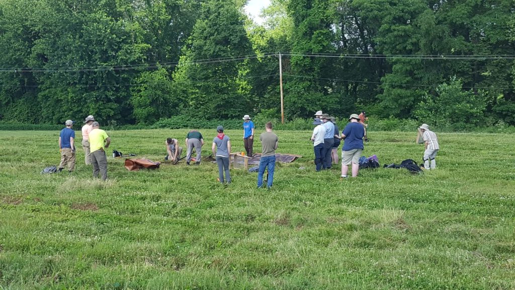
On our first day at our field school in archaeology, we searched through the soil for mountain peaks: or rather, mountain peak-shaped rocks. That’s the tip we were given for finding flakes -fragments of stone produced by Native American flintknapping.
Flintknapping is the process of chipping away at a stone to make a point for stone tools, with flakes as a byproduct. The edges and ridges on flakes slope across their surface, giving them a mountain peak appearance when viewed from the side. Few of us had ever done fieldwork before, so we were enthusiastic about finding real flakes which we had only seen before in images and diagrams.
By the end of our two weeks, we were lucky enough to have seen so many different Native American and Colonial artifacts that finding flakes became commonplace.
Juniata College Field School
Our field school took place in Halifax, Dauphin County, Pennsylvania at Fort Halifax Park where we camped out near the Susquehanna River for two weeks. The field school was offered through Juniata College and supervised by Dr. Jonathan Burns. The project was supported with a Keystone Historic Preservation Planning Grant from the Pennsylvania Historical and Museum Commission and a Louis J. Appel, Jr. Preservation Fund Grant from the National Trust for Historic Preservation.
During our time there, the Friends of Fort Halifax, the nonprofit organization that works to preserve and maintain the park, provided meals and support for us. Thanks to our camping accommodations, to the support of the PHMC and the National Trust, and to the Friends of Fort Halifax, our field school was more affordable than the average field experience. This, along with the field school taking place in Pennsylvania, our home state, was the major reason we both chose this experience.
Fort Halifax
Fort Halifax, established by Colonel William Clapham’s battalion, was used during the French and Indian War primarily as a line of communication for nearby Fort Augusta, from June, 1756 to October, 1757 when it was evacuated. The land was already inhabited and farmed by the Armstrong family when Clapham arrived, and the troops used the Armstrong’s sawmill to help construct the fort.
In the historical record, there are two conflicting diagrams of the fort, and both possible layouts were considered possible. Both diagrams depict a fort that is approximately 160 feet square.
Archaeology at Fort Halifax
In 2011, 2012, 2013 and 2015, fieldwork was carried out in the park, which helped narrow down the potential location of the fort. The specific area we worked on was selected based on the wording of an early 20th century historic marker along Route 147, on the suspected size of the fort, and on the presence of two irregular low mounds of soil on otherwise flat ground.
In April 2021, a ground-penetrating radar (GPR) survey was conducted by Dickinson College in the project area. The GPR detects disturbed areas below the surfaces, and while some disturbances were detected, the GPR survey was unsuccessful in finding any major fort features. Metal detecting in the project area was more successful and produced many colonial artifacts.
In total, our field school excavated 53 test units, which were one meter-by-one-meter pits dug into the ground through the plowed soil (the A horizon) to the top of the underlying sub-soil or B horizon. These unit locations were selected based on the results of metal detecting, as well as on the expansion of features found in existing units. Features are buried evidence of human activities such as cooking fires, foundations, and post molds.
The excavations, metal detection finds, and test units were mapped using a total station and grid which provided geospatial information including distance and elevation. In addition to the test units, a five meter long, half meter wide trench was excavated in one of the low mounds in the field. Excavated soils from test units and the trench were sifted through a ¼ inch mesh screen, with soils from potential features sifted through a finer screen. As the units were excavated, we learned to fill out thorough paperwork and map the different soil levels and features we found.
The results of this fieldwork led to a major discovery, and also to a great learning experience for both of us and for all the students in the field school.
To be continued… return next week to read about what we found and what we learned!
This week’s post is by Guest Contributors are Maria Pauline and Sarah Paterno, students from Penn State University who participated in this past summer’s Juniata College Field School at Fort Halifax.
Comment Policy
PHMC welcomes and encourages topic-related comments on this blog. PHMC reserves the right to remove comments that in PHMC’s discretion do not follow participation guidelines.
Commenters and Comments shall be related to the blog post topic and respectful of others who use this site.
Commenters and Comments shall not: use language that is offensive, inflammatory or provocative (this includes, but is not limited to, using profanity, obscene, or vulgar comments); disparage other commenters or people; condone illegal activity; identify the location of known or suspected archeological sites; post personal information in comments such as addresses, phone numbers, e-mail addresses or other contact details, which may relate to you or other individuals; impersonate or falsely claim to represent a person or an organization; make any commercial endorsement or promotion of any product, service or publication.
If you would like to comment on other topics not related to this blog post but related to PHMC, please fill out the PHMC Contact Us Form.
