
Head’s up! Changes are coming to the PA SHPO in 2017! As many of you out there may be aware, our office is working hard behind the scenes to construct and prepare for a 21st century system to manage our survey and resource data as well as provide a platform for electronic environmental review and consultation under all of our SHPO programs.
To transition to the future of all-electronic submissions, SHPO staff have put their heads together to identify small changes that can be made in how we do business. Make sure to attend the upcoming Statewide Conference on Heritage from Wednesday, June 14 to Friday, June 16 in Carlisle to learn more about these upcoming changes!
These are the top 5 Things to know about upcoming changes:
#1: Guidelines Updates
As part of this effort, this year there will be a series of tweaks, updates, and changes to the Guidelines for Archaeological Investigation and the Guidelines for Architectural Investigation– culminating in a formal update to both Guidelines incorporating all of the changes this November.
Starting May 1st, streamlined submission!
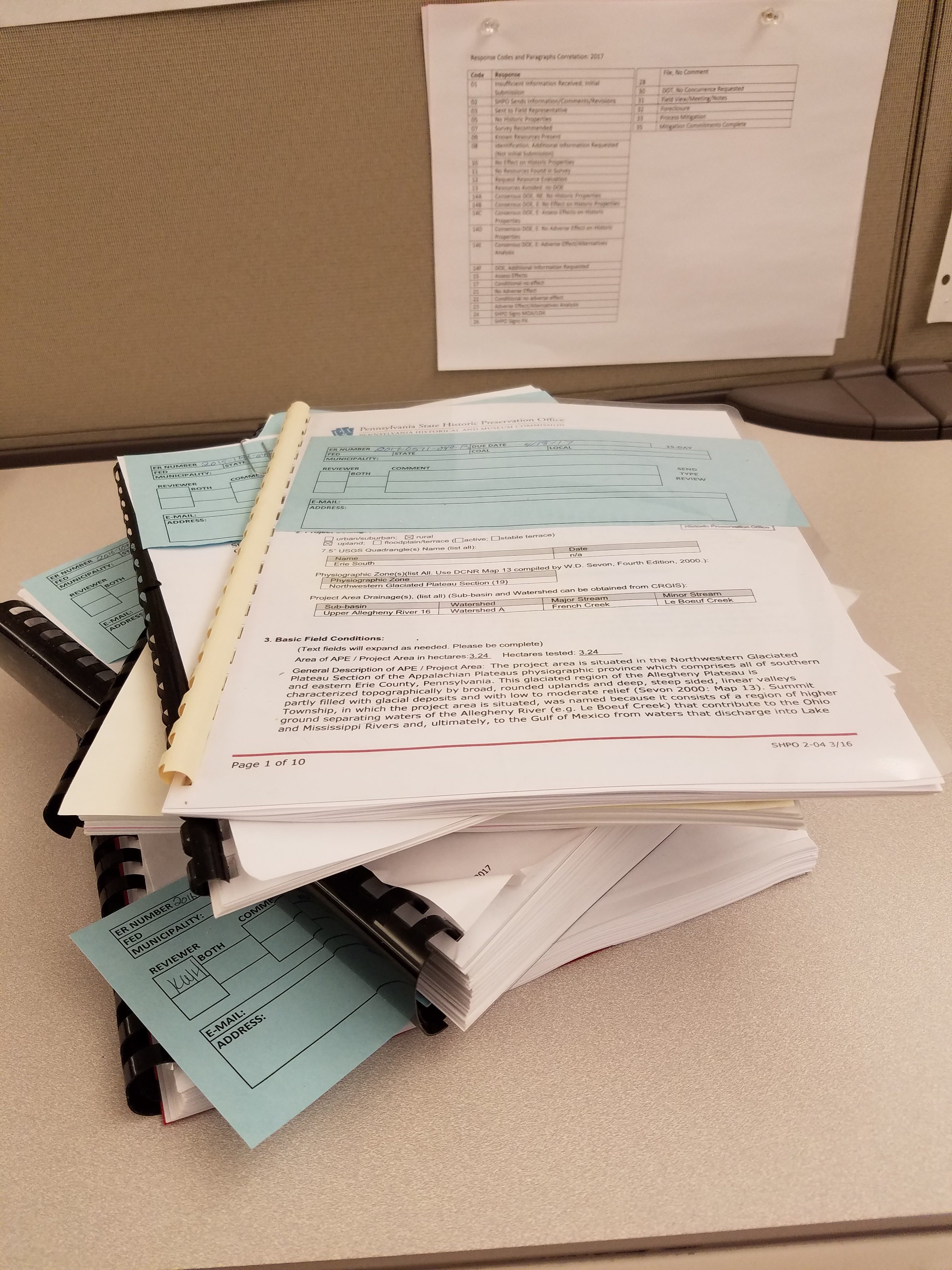
#2: Submitting Project Review Reports and Forms
There is also change in how we collect electronic and hard copies of archaeological and architectural reports and forms. Beginning Monday, May 1, our office would like to receive the following as the initial (draft) report submission package:
- One .PDF copy of all reports and forms (including updated PASS forms if sites are present) on one CD. The report and each form should be saved as separate .PDF files.
- One shape file that includes the project area and all archaeological site areas or architectural resources. The project area shape file should represent the area where archaeological and architectural resources were considered.
- One bound report hard copy and separate hard copies of each form. Report binding should consist of comb or spiral binding.
- Architectural reports will now require a copy of the report summary form be included in the appendix.
If the draft report or form is accepted with no revisions, no additional copies – either hard copy or electronic – will be requested.
Archaeology and Preservation50
#3: Archaeological Site Criteria Updates
There will also be updates to the archaeological site definitions later this month and to the archaeological site forms later this year. Our office has been working with the State Museum of Pennsylvania archaeology staff to clarify the current site definitions as well as to tweak the existing site forms to reflect changes. The affected forms include the Pennsylvania Archaeological Site Survey (PASS) Form and the Isolated Find or Non-Site Collections Form. This update will be circulated later this year and presented in the upcoming Guidelines revision.
#4: Abbreviated Historic Resource Survey Form
For above ground resources, there will be a new Abbreviated Historic Resource Survey Form to be used in documenting complexes that are clearly not eligible for National Register listing has been developed. Guidance for providing the results of reconnaissance surveys in table format will also be provided. Stay tuned over the next few months for more info!
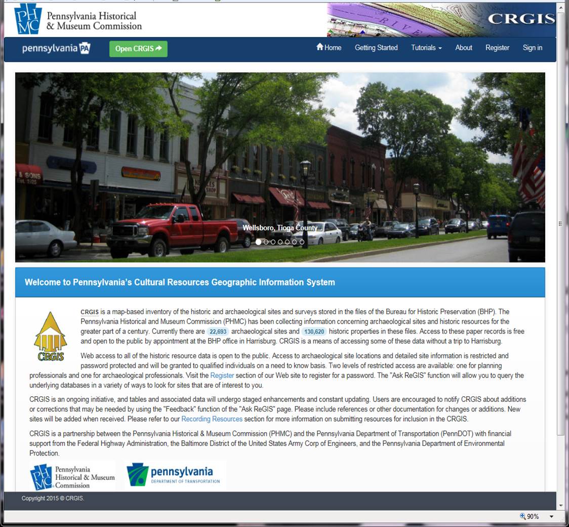
The CRGIS landing page revamped and relaunched in 2015.
#5: CRGIS Updates
Also, later this summer, we are eagerly anticipating another much-awaited update to the CRGIS that will allow for the electronic submission of forms and report summary forms. The details for how this new service will work and when it will be available are still being developed, but any changes to the Guidelines associated with this effort will be announced in the fall revision.
We are looking forward to an exciting year as we work with you to prepare the SHPO office and our programs for our 21st century makeover! Stayed tuned to the blog and, if you haven’t already, sign up for the PA SHPO newsletters (the quick form is on the blog homepage!) to stay up to date on what’s happening.
The requirement to submit shape files with project submittal is a concern to me. The small one person firms, many run by highly competent older professionals, may not have GIS capabilities. I myself may be one of these with my own firm in the near future, but am now concerned I cannot without buying an expensive new computer that can adequately run GIS in addition to everything else. Additionally, I have a part-time job with a firm that currently does not have GIS at my office. Although I understand the request, I am not in support of it being a requirement.
Thank you for your comment, Becky. We understand that some small firms like the ones you mention might not have the capability to send in shape files with their project submittals, and we don’t expect them to do so. The medium- and larger-sized firms that do have GIS systems and can submit shape files are expected to do so. If you have any questions about submitting shape files for a particular project submission, please talk to the project reviewer handling the project and they will help you work through what is needed
Shelby,
Can you explain how your response is even legal given the press release submitted earlier? Why would a large company bid on a job they are highly capable to complete, with all shape files included, when you can just give it to a Mom-n-pop shop because you want to. This is stupid and illegal.
Mr. Buckley, thank you for your comment.
We would like to take this chance to provide some additional information on why we are changing our submission procedures to include GIS spatial data– see our Geospatial standards on our website.
Our office is in the process of realigning our submission guidelines and internal work flows to prepare both our staff as well as our constituents for our new electronic data management and GIS submission system. This system will be coming within the next two years. With the introduction of the new system submissions for project review (as well as many other programs in our office) will depend on the use of GIS data for all submissions.
Based on the materials we are receiving currently most archaeological firms, both large and small, are using GIS software for their mapping. Our office feels that shifting to the use of GIS data ahead of the new system will both prepare everyone for the future as well as enhance the accuracy of current mapping on the CRGIS. Those few firms who are currently not using GIS mapping software should notify our office of that fact in the cover letter for each submission lacking GIS spatial data files. All others will be expected to provide these files as part of their draft submission packet.
We are confident that these changes in our submission standards will ultimately be a benefit to everyone, and we look forward to working through this and all of the other coming changes with all of our partners.