Bedford and Cameron Counties are the latest counties to be surveyed as part of the Pennsylvania State Historic Preservation Office’s (PASHPO) Disaster Planning for Historic Properties Initiative, following up on the surveys done in Monroe County and the City of Philadelphia by AECOM Technical Services.
Architectural historians from AECOM canvassed the two counties to catalog historic resources over 45 years of age within 100- and 500-year flood hazard areas. Each county presented a remarkable variety of historic structures, from the Bedford Springs Resort — a National Historic Landmark in Bedford County – to Civilian Conservation Corps structures in Cameron County’s Sizerville State Park.
AECOM sought to locate and document significant historic resources from vernacular to high-style in design, and ranging from Colonial-era to mid-century modern in period, in order to thoroughly identify flood-prone historic resources in the two counties.
Bedford County
In Bedford County, a county of just over 1,000 square miles, surveyors combed valleys and waterways for historic resources within the flood hazard areas that are listed in, eligible for listing in, or potentially eligible for listing in the National Register of Historic Places, or are locally important “community landmarks.”
Throughout this survey, AECOM documented a variety of farms, mills, covered bridges, and dwellings. Among the more noteworthy property types in the county are its collection of extant 18th and 19th century log buildings.
Within a wide floodplain adjacent to Bob’s Creek in East St. Clair Township, architectural historians encountered a property with a mid-19th century two-story log dwelling and agricultural outbuildings. Archival research indicates that this was once the farm of Henry Yout (or Yount), as noted on the 1861 Map of Bedford County by E.L. Walker and the 1877 Atlas of Bedford County by F.W. Beers & Co.
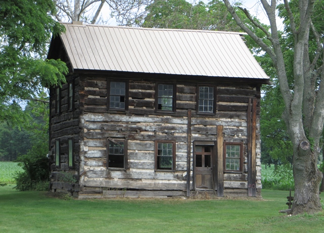
Log dwelling in East St. Clair Township, June 24, 2016.
Photo provided by AECOM, Kaitlin Pluskota, photographer.
Though many of the county’s log buildings have been encased in modern siding, intact examples, such as this one, remain. If a major flood event were to occur, these structures would obviously be in jeopardy, and their importance to Bedford County could be lost.
Another of Bedford’s significant resource types are its many mills, such as the Juniata Woolen Mill. Situated on the west bank of the Raystown Branch of the Juniata River in Snake Spring Township, the 1805 mill was established by John Lutz, the son of a German immigrant. Among its many products, the mill produced woolen socks and blankets for the Union Army during the Civil War.[1]
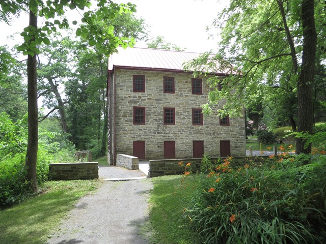
Juniata Woolen Mill in Snake Spring Township, June 24, 2016. Photo provided by AECOM, Kaitlin Pluskota, photographer.
The mill, listed in the National Register of Historic Places, already has suffered from a natural disaster. In 1936, a major flood destroyed a log portion of the building that housed a water intake channel and turbine to power the mill’s machinery. Some flood-protection measures have been taken to reduce the damage that the structure might sustain in a future flood, such as stepped stone walls on the river bank to protect from riverbank erosion and flood debris.
Also located in Bedford County’s flood hazard area, the National Historic Landmark Bedford Springs Resort is a significant historical and architectural feature in Bedford Township. On land purchased in 1798, Dr. John Anderson built facilities for his patients to benefit from the mineral-rich waters. Currently there are eight known springs on the property, with various mineral properties.
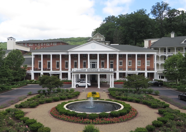
Colonial Building at the Bedford Springs Resort, June 29, 2016. Photo provided by AECOM, Kaitlin Pluskota, photographer.
Built 1838-1842, the brick Colonial Revival building forms the centerpiece of a five-section hotel building built throughout the 19th and 20th centuries and now stands as an elegant and spacious hotel property with conference facilities, pavilions, a golf course, and outdoor recreation space; all of which fall within the flood hazard area. The property reopened in 2007, after being vacant for over two decades, rehabilitated with the assistance of historic tax credits.
Shobers Run is fed by the Raystown Branch of the Juniata River, and winds through the Bedford Springs Resort property. A flash flood in 1983 severely damaged a number of buildings on the already dilapidated property.
Overall, Bedford County is an evocative landscape full of significant history told through its buildings, sites, and structures. Many of these are vulnerable to damage if a flood hazard event were to occur, and will hopefully be protected against the potential of future destructive waters and severe weather. This project aims to document those that are vulnerable, and provide data to assist with flood mitigation planning.
Cameron County
Cameron County is one of Pennsylvania’s smallest counties, both in terms of size and population. Formed in 1860 from portions of surrounding counties, Cameron County’s primary settlements are clustered in the valleys of the Allegheny Mountains and along rivers and streams that feed the West Branch of the Susquehanna River. Heavy flooding is a regular occurrence in the towns and villages of Cameron County, making it a prime candidate for this survey.
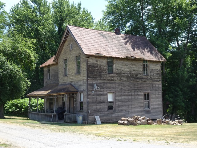
Late 19th Century Frame House in Driftwood, July 7, 2016. Photo provided by AECOM, Jennifer Robinson, photographer.
Cameron County’s first significant settlement occurred in the mid-19th century and its early economy was largely shaped by extraction industries, namely coal mining and lumber harvesting. The lumber companies first utilized the many rivers and streams to transport logs downstream, and railroads were established later on in the century to transport raw material out of Cameron County. Lumbering and mining were, by nature, transitory industries, and little infrastructure remains. All of Cameron County is now included in the Lumber Heritage Region of Pennsylvania.
Small permanent villages did develop though, generally along the flat areas near the rivers in the second half of the 19th century. While many of these villages are now lost to time, some, such as Driftwood, Sinnemahoning, and Sterling Run persist today. There surveyors documented numerous civic and religious properties as well as transportation-related structures and cemeteries. Among the oldest surviving are several early frame combined schoolhouses/churches and community buildings.
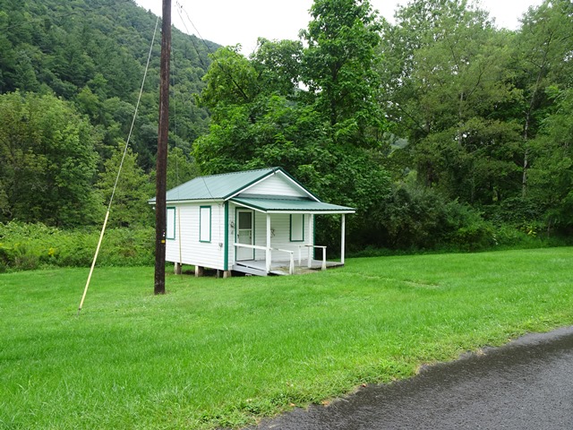
Former Sinnemahoning community center, located near the banks of Sinnemahoning Creek, August 31, 2016. Note the elevated pile foundation. Photo provided by AECOM, Jennifer Robinson, photographer.
Cameron County retained its rural and rugged character well into the 20th century. During the Great Depression, numerous Civilian Conservation Corps (CCC) camps were established in the county to provide training and employment to out of work young men. The camps in Cameron County constructed bridges, parks, and roads among other infrastructure improvements. This survey identified several CCC structures with high architectural integrity within the flood hazard areas.
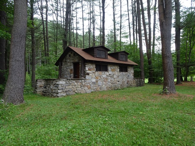
CCC Built Restroom at Sizerville State Park, August 31, 2016. Photo provided by AECOM, Kaitlin Pluskota, photographer.
Cameron County today is 92% forested. The county’s abundant state park and game land attract many seasonal hunters, fishermen, and campers. Hunting camps and vacation homes are abundant in the county, and many of the camps reside in repurposed historic structures. AECOM’s survey identified a few unique instances of this occurrence, such the ca. 1880 Highspire Hunting Lodge, which is housed in a former schoolhouse.
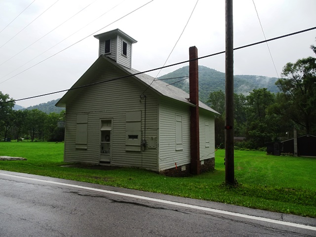
Highspire Hunting Lodge in Former Schoolhouse along Route 120, August 31, 2016. Photo provided by AECOM, Ben Buckley, photographer.
These resources are an indelible record of what remains of the historic built environment in this rural county. It is imperative that they are considered, protected, and monitored during severe weather events. The preservation of the historic materials, workmanship, and landscapes is critical for the knowledge and inspiration these structures and sites provide for generations to come.
Benjamin Buckley is an Architectural Historian for AECOM Technical Services, Inc. based in Burlington, New Jersey. Mr. Buckley earned a B.A. in Art History from Kalamazoo College and an M.S. in Historic Preservation from the University of Pennsylvania. He resides in Philadelphia.
Jennifer Robinson is an Architectural Historian for AECOM Technical Services, Inc. A recent addition to the AECOM Cultural Resources Department based in Burlington, New Jersey, Ms. Robinson is a Philadelphia resident, former intern at the Preservation Alliance for Greater Philadelphia, and a new member of the Young Friends of the Historical Society of Pennsylvania board. She has a B.A. in Cultural Anthropology from the University of California, Berkeley and an M.S. in Historic Preservation (MSHP) from the University of Pennsylvania.
[1] Osipov, James. The Juniata Woolen Mill Master Plan: Mill and River Setting.
0 Comments
1 Pingback